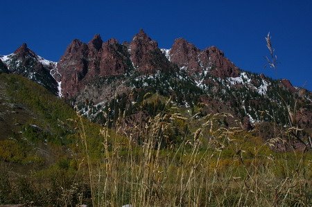
Wednesday, October 04, 2006

Elbert Day

(Thursday, Sept 28)

The plan was to get up around 6:00 am so we could be on the trail early. Since we didn't have a 4 wheel drive vehicle, an extra two miles each way was added to the climb. The total climb would be almost 6 miles. I had bought an Independence Pass topo map at the forest service office on Wednesday, and I could see the end of Twin Lakes at one edge.

Before we left the cabin, I couldn't find my hat. It wasn't in the car, either. I figured I must have left it down at the creek the evening before. Sam and Vicki had remembered me messing with my hair before we left for the creek yesterday -- wouldn't have done that if I'd been wearing my hat -- but we weren't quite sure. We drove down to the creek, and didn't find it. I miss my hat. That hat and I have spent most of my time in the mountains together. It keeps rain off my head, sun off my face and neck, and out of my eyes. It keeps my head warm when it's cold. Plus, I bought it in San Diego (my birth town) and I'd been looking for just such a hat for a long time. I hope it turns up later. Vicki and I needed to get climbing, and it was already after 8 by this time.

Sam dropped us off a little ways up the 4 wheel drive road -- as far as the Taurus would make it. That was about 0.2 miles. We set off, and Sam went back to the creek one more time to look for my hat. He was going to climb some and take some pictures, but he had no plans to continue to the top.

We came to a fork in the road, and there was no indication which way to go. The trail didn't appear to be on my GPS, so I looked at my map. I
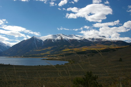
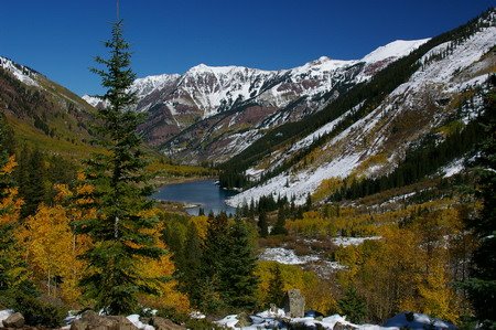
saw a 4 wheel drive road that split and then came back together after a half mile or so, so I thought it didn't matter. We went up the shorter, steeper fork in the road and ended up in an alpine meadow. The view was awesome of Twin Lakes and the surrounding mountains in the morning sunlight and clear blue sky. We crossed the meadow and the road turned west, just as the map suggested, and we went through some beaver ponds and ended up by a rusted metal sign like the one at Willis Gulch -- but this one was more clear. Mount Elbert, thataway! It wound around another beaver pond, and we came to another fork. There was a large bulletin board with signs over to the left across a bridge, saying "please stay on the trail", etc. I figured the right way to go was over that way, then -- though there was no real indication. I figured the trail would wind back up to the north eventually, even though this way was southwest. And soon we came across one more fork in the road. One that went back down toward the car, the other lead up, and quickly. Again, nothing indicating which way was the right way -- just CTD trail, and arrows pointing ... well, pretty much in all directions. We trudged up the steep one in earnest. After all, we had 5,000 feet to climb.
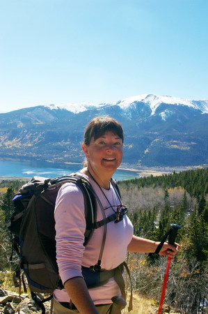
It was some of the steepest hiking I've ever done, but it was walkable. It appeared at this point to be another 4 wheel drive road. We wound up several switchbacks, through signs that said "Public Road through Private Property Ahead, Please stay on road" or something to that effect. I knew Lily Pond was on private property, so I figured that must be it.

However, we got up to about 11,500 feet and I hadn't seen the pond yet. Something was wrong. We called Sam. He said he hadn't found the hat, and that he was sitting in a meadow. We thought it must be the one that we'd come across. But after talking to him a bit, I figured out it wasn't. I got the map out, and zoomed out on the GPS.

We were on the wrong trail, headed up a peak to the south of Elbert. We asked Sam if he'd come across a bridge. He had. He said there was a sign pointing the way to Mt. Elbert, and we thought it must be the one we saw. We must've missed something. At any rate, it was 11:30 by now and I knew we wouldn't be making the summit today.

We agreed to go meet Sam wherever he was and headed back down the old mining road. We crossed the bridge, and to our surprise there was a fairly obvious wooden sign pointing to Mt. Elbert ... the opposite direction we'd taken when we'd come to this fork. From the direction we'd come, that sign was behind a large willow bush, and facing the other way. We'd missed it completely (Picture to right: red is the way we came and went, green is the way we should've gone) We went by a few large, smelly beaver ponds which I realized was the Lily Pond area, and through a large aspen grove. Then another sign saying "Mt. Elbert" which pointed to a trail that went up... fast. Sam said he wasn't far up that trail. Vicki was tired. Heck, I was tired. We went up several switchbacks and soon got to snow, which made the trail slippery. Thank God for the hiking poles. These were new to us, but they were proving their worth today.

Still no Sam. Vicki needed to sit down, and sat down on a log right in the snow. We were at about 10,300 at this time. Sam had hiked a little higher. I told him Vick could go no farther, and he started back down toward us. He appeared within about 10 minutes.

I was bummed. I'd lost my hat, we didn't make it to the top of Elbert. We hiked back down to the car, and I noticed I couldn't focus on anything with my camera. The focus ring had come loose on the lens. Strike three. Bummer of a day, I thought.... knowing that the sights I'd seen were fabulous and I shouldn't be thinking that way.

Back up on the trail a couple of hours before as I was muttering about losing my hat, Vicki mentioned that Sam and I had gotten out of the car at Twin lakes the day before near the Elbert Trailhead parking area. It was then I remembered that I had taken my hat off -- even moved it when I moved once, but still had it laying on the ground -- so I could get down low and look through the camera viewfinder. I'd even told Sam (not that I thought it was his responsibility) "don't let me forget my hat."

Well, I remembered -- that's what must've happened. I had it at the Maroon Bells, I had it in Independence, I didn't have it at the cabin or the creek. That had to be it. It had been left on the side of 82 by Twin Lakes, and there was a decent chance someone had seen it and picked it up.

But there was a decent chance also, it being the middle of the week and less than 12 hours of daylight ... that it MIGHT still be there. We drove up to that spot. And there it was, right where I'd left it. Sam said it was a real mountain hat now, having survived a night alone on a mountain road. It's been through a lot more than that in the mountains, but I agreed, just thrilled to have it back.

I told Vicki and Sam the reason we didn't make it to the top of Elbert was ... I didn't have "The Hat of Power". I put it on. I felt a little better.

When we got back to the cabin, I tried focusing the camera on various things to see if I could get the focus ring back on right. But no matter what I did, manual or automatic, it wouldn't focus on anything. Now that's just odd, I thought. At about that point, I started looking for other things, and I noticed there is an eyepiece focus adjustment on the camera. I put it in the middle, and tried focusing again. Bingo!

There was nothing wrong with the lens after all, the eyepiece focus compensation was just out of whack. I figured out which way the focus ring went on -- and we set off for Vicksburg, a few miles south and west of us. Two strikes of my three strike day had been revoked. I was feeling better. But I could feel Mt. Elbert scoffing at me.

It was getting late in the afternoon, and we were driving west into the valley where Vicksburg lay. The sun was shining through the aspen leaves, and we were pretty much gasping at the views on every turn. Sam and I got out to shoot a lot of pictures (still need that oversized lens
hood!!!). Missouri Mountain was in this valley as well, and I was trying to figure out which one it was. We saw trailhead parking for Missouri Gulch, and across the road was parking for Vicksburg Museum. We saw a couple of cabins, but figured that couldn't be the "Ghost Town" we were looking for. A gate was closed, and it said "Private Property". So we pulled in to the trailhead parking to see if there was any Vicksburg information there. It had to be close, according to the map. There were a couple of guys, one from the Oklahoma University Health Sciences Center (and I think maybe his son?) camped out there, about to make a two day assault on three 14ers, including Missouri Mt., Mt. Belford, and Mt. Oxford. I was jealous ... and interally shamed at my failed attempt today on Elbert -- all in all probably an easier climb (though I guess I don't know that for sure, but that's what I thought!) Talked with them a while, and they said they had the same problem at Elbert before -- it was poorly marked. They went up the same peak we had started up (only they went all the way to the top of it at least) So I felt a little better.
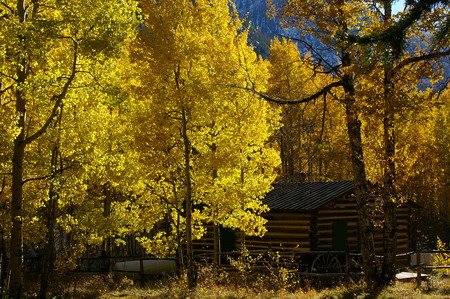
They encouraged me to try again, and I told them I was thinking about it but frankly I was beat from today's feeble attempt and I knew Vicki wasn't up for it. She encouraged me to try as well, though. A solo attempt. Hmmmmmm. Maybe. We went back to the place that said "Vicksburg Museum Parking" and a couple was emerging from the area -- that was indeed it, you just had to go back a ways to see the other cabins.
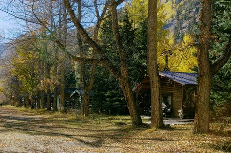
They were boarded up for the winter. As a matter of fact, it's not acutally a ghost town at all. The cabins are owned, and lived in during the summer - mostly by decendents of the original owners. Some you can rent out. There was a little of the self-guided tour the forest service office lady had mentioned. We read some of the signs and listened to a recording. Took some pictures, and went back home for a spaghetti dinner.
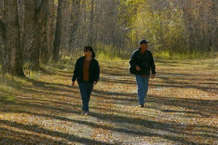
Back to the Bells

(Wednesday, Sept 27)

Wednesday morning -- no concrete plans. A cold front was to move through today, so we decided it wasn't a good day to climb Elbert -- could get windy, especially above the tree line, and today was the best chance of a freak storm up there. Sam was disappointed in his tungsten-blue pictures of the Maroon Bells from Monday, and I was thinking Ghost Town. Vicksburg sounded big -- and more touristy, and I was thinking Independence -- on the other side of the pass. Sam liked that idea, because if we were going that far we might as well go all the way to the Maroon Bells again on our 5 day pass. So that's what we did. Got a little later start but didn't stop to take many pictures over the pass this time. There was a bit of a traffic jam in Aspen -- we sat dead still for about 20 minutes. We ended up getting to the Maroon Bells about the same time as Monday.

Color was still good, but many of the trees that were dropping leaves on monday were now bare or nearly bare, and you could see the grey scars on the mountainsides.

Vicki decided to try her bandaged heel out and hike to the bridge past the lake. I took a few pictures and sat by the lake enjoying the atmosphere and the view. Talked to a professional photographer ... probably in his 60's... and his wife. I asked her if she was a shutter widow, too. She laughed and said yes, she just learned to tag along and enjoy and listen. A couple of young ladies came along and were taking shots of each other. I advised them to use the fill flash so they could see their faces and I showed them how to do it on their camera -- and offered to take a picture of them together. Worked out fine.

A quite mature but energetic woman approached me asking if she could impose on me. I figured she'd want me to take a picture of her in front of the mountains and email it to her. Close. She didn't want to be in the pictures, she just wanted me to send her one that I took. Neither of us had a pen or paper... but I found my checkbook. There were carbons in there, and I figured I could scratch her address out with a small stick on one of the carbons -- and it worked. So I'll send it to her.

Mean time, Sam walked around the lake as well taking pictures and caught up with Vicki at the bridge. We soaked up a little more "Bells", and headed off to Independence. Sam went back to Wolf Photo bought a 4-pak of 3V camera batteries -- his Nikon takes 3 in a little emergency pak to replace the proprietary Li rechargable battery that comes with it.

We'd forgotten lunch, but Sam and Vicki had protein bars from the day before and Sam still had a bag of trail mix, so we made do.

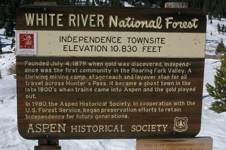
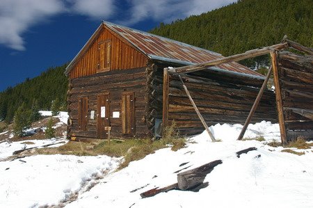
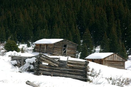
Got to the abandoned metropolis of Independence around 2:00 pm at about 10,800 feet. It was once a stagecoach stop between Twin Lakes & Aspen, and apparently also housed miners at one time. There are about 15 or so buildings there, half of which are still basically standing. All old wooden buildings. Pretty neat, and what a view! Guess it was just to cold & snowy and remote to remain a town.

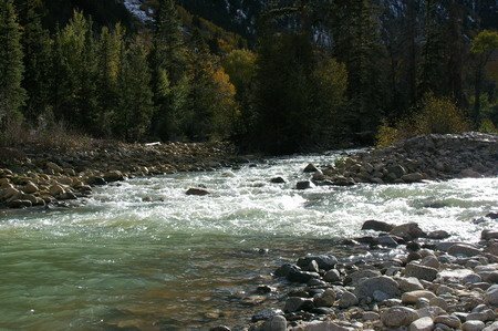
We decided to go back to the cabin and grab some beer & whiskey and head back to the Willis Gulch trailhead which was right by a nice sized mountain stream with a big gravel/boulder bar and braided channels. We sat and watched the sunset, talked, had a few brewskies, threw rocks in the river.... just hung out -- which is something I never do enough of out in the mountains. I'm always trying to squeeze one more thing in. It was 3 hours well spent.

Came back to the cabin and made a spaghetti dinner, and I made up some oatmeal & boiled eggs for the morning... because tomorrow.... is Elbert Day!

Tuesday, October 03, 2006

Twin Lakes, Willis Gulch

(Tuesday, Sept 26)

Tuesday we decided to try something a little closer to home -- a hike up around Lake Creek, the one that dumps into Twin Lakes up by Twin Lakes. We went in to Granite first for gas and some sunscreen. We got burned from the wind and sun at Maroon Bells the day before, and the snow didn't help. The store owner was a bit grumpy -- Vicki tried to engage him in conversation. Maybe it was a bit early in the morning. We got our gas & sunscreen and left. Stopped at the Twin Lakes store and met a lovely mountain girl (woman -- she was a grandmother) tending the store. She gave us all kinds of advice -- from climbing Elbert, when to start, who died and why, etc. She had a nice dog named Cassidy as well. We asked her about the Willis Gulch trailhead, and she said it was about a mile and a half down the road.

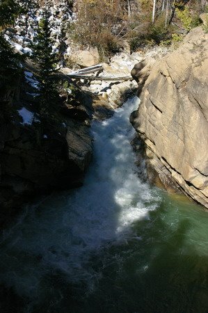
The place across the street advertised "The Best Coffee in Colorado" -- and Sam went over to fill his cup -- but they were out and apparently the Coffee Man was out doing chores. Too late in the morning, I guess. We drove down to the trailhead and tried to guess which trail was which. We ended up in a campsite next to 82 -- pretty trees, and a small gorge with water raging through it. But it wasn't the Willis Gulch trail. We headed back, and passed something that looked sort of like a trailhead, but it didn't say which trail. It was a rusted metal sign with stenciled letters cut out of it.

We went back and compared the topo map with the GPS and I insisted that Willis Gulch was on the other side of the ridge sloping off of Twin Peaks to the east. Sam decided that meant the rusted sign was the trailhead, and we traipsed off down the trail. It wasn't long before the trail split -- one said "Twin Lakes Trail" continuing to the East, the other said "Little Willis". Not excactly clear. We picked "Little Willis", and started climbing steeply up the slope of the ridge.

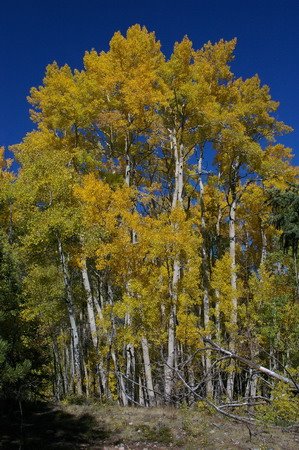
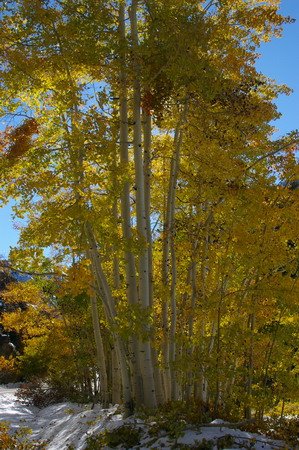
The way the trail looked on the topo map, we thought it should stay along the bottom of the ridge and turn up the gulch later. I decided we were on the wrong trail, climbing some peak called "Little Willis" (turns out I was wrong, we were on the Willis Gulch trail -- but it worked out). We followed the Twin Lakes trail 150 yards or so more and ran across a group of three women we had met by the car. They were having a picnic and wine by some boulders. I took some shots of aspen in the mouth of Willis Gulch, and Vicki and Sam hiked on in the meantime. Suddenly I heard Vicki say "Oh my Good Lord in Heaven, Phil!" -- which I took to mean "Wow!" Which was the correct interpretation. Because the next 1/4 mile of trail had some of the best aspen scenery we'd see all week. There was a grove of tall, bright yellow ones against the clear blue sky. Got several shots of that, and we hiked on through an incredibly large grove of aspens dropping leaves like gold flakes onto the trail, carpeting it like something out of Rivendell in Lord of the Rings. A few symetrical spruce and some colored underbrush punctuated the forest, and we were literally in awe.

Sam got ahead of us, and Vicki and I caught up to him sitting by the stream coming out of Willis Gulch toward Lake Creek. We had a snack, and decided to head back to the car. I wanted to visit the Forest Service office in Leadville to find out about conditions on Elbert and get an updated forecast for the week, and they probably closed at 5:00. Sam and I decided it would be faster to follow the trail through the marsh on the western edge of Willis Gulch back to 82 and hike back to the car. (Later I figured out it would have been much shorter to go back the way we came... but ... well, read on).

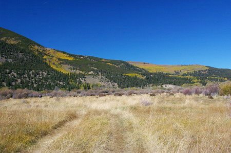
We hiked out of the woods to a field at the edge of the marsh. It was obviously a fairly often used ATV trail at this point, and dried grasses stretched between the woods, another large aspen grove, and willow shrubs in the marsh stretching to the lake off to the east. After hiking through some willows, we came upon Lake Creek -- a braided stream through gravel bars at this point on the homestretch to the lake. We looked for a place to cross.

To our surprise, there was quite a bit of water rushing through the creek even on this flat-ish land, and there were no obvious places one could rock-hop across. The best place I found I could see was about knee deep at the worst, but the current was pretty strong there. Sam went downstream and found a place where the braids multiplied, offering a way across several of them, but the final channel was about waist deep -- way too deep for this current. So we went back to the spot I found.

I sensed Sam and Vicki were skeptical, so I just took off my shoes, rolled up my pants, and proceeded across with my hiking poles for balance and bracing against the current. I was across pretty quickly, and my Bass Pro Teflon pants, though they unrolled a bit into the water, did their thing and didn't get soaked. They would dry quickly.

My trek convinced Sam & Vicki it was a viable trip, so they followed suit. I thought about Vicki's diminished balance since her acoustic neuroma surgery and decided to go back across and carry her pack and stand behind her downstream on her way across -- both for encouragement and to help her keep her balance. Don't want any bad experiences keeping her from wanting to hike around in the mountains!!!! ;-)

This being my third crossing of the stream, and the stream being snowmelt, my legs were numb from my calves to my feet, but I knew it was only a minute or two and I'd be fine. We all got across. I sat down to put my shoes and socks back on. And I noticed.... blood... on the rocks... by my shoes. Who cut themselves? I didn't feel anything, couldn't have been me. I looked around. Then I checked my right foot. There was a sizable chunk of skin missing from the ball of my right foot. It wasn't bleeding much, but that's where it was coming from. I didn't feel anything, and it wasn't bleeding much -- because of the cold water. Apparently I cut it on a rock on one of the crossings. Patched it up with the first aid kit, put my socks and boots back on, and we trekked off through the willow bog.

Unfortunately, the trail had sort of vanished. We continued on what was probably a deer trail. We could see the town of Twin Lakes and the road, it wasn't like we were going to get lost. We made a bee line for the road.

The trail crossed several more less palletable small streams with lots of rotting vegetation -- you could smell the beaver musk and rot. But at this point, this was the best way to go. We knew we were crossing a bog when we started and we might run in to stuff like this, but had been over-sold by the dry start on the south side of it.

We emerged at the road, and by the mile marker I figured we had a little more than a mile hike down the shoulder of 82 to the car. Sam got a phone call and slowed down, and Vicki and I kept hoofing toward the car.

A woman pulled up in a car and got out, saying she was shooting for a website on Colorado... things to do... and wanted to know if she could shoot me hiking down the road. Guess it was the hat and the World Wide Sportsman garb from Bass Pro. She shot some pictures and took off. We made it to the car at about 4:00, circled back, picked up Sam, and tore out toward Leadville and the Forest Service office. Half an hour later that I'd planned, but all in all, I was optimistic, as Leadville is about a 25 minute drive away from here.

This wasn't a big office like the one in Idaho Springs, but I did end up talking to the young lady behind the counter. The forecast was now for a cold front to come through tomorrow (it was 70 degrees that day in Leadville) -- with a few clouds and little chance of precipitation. Thursday and Friday looked sunny.

She also said that over the weekend there were reports of knee-deep snow above the treeline on Elbert. Hiking it might be difficult. At any rate, I decided an Elbert try would have to wait until Thursday or Friday, leaving tomorrow open.

We asked where to get a good burger and beer, and they recomended Rosie's Brew Pub -- the highest brew pub in the country (everything's "the highest" in Leadville - the town is at 10,200 feet).

Rosie's was good, indeed. We stopped at a drug store on the way out for some big bandaids for Vicki's blisters... plus she wanted some chocolate.

Got those, and went home.

I wanted to go up above the treeline again the next day, and that meant going over the pass. Maybe find Independence, a ghost town on the Aspen side of the pass. Sam said as long as we were going that far, we might go back to the Maroon Bells. Our pass was good for 5 days.

Twist my arm.

It turned out that the color balance on Sam's camera that day was set for tungsten, so most of his pictures turned out blue. He wanted another shot at them.

To bed again.


(the following picture isn't for the trip. It's just so I can use blogger's "free web hosting" for my profile picture. This is from the Aug 2007 trip. I just needed someplace to stash it.)

Monday, October 02, 2006

Bonus Pictures

Several of the locals, especially the many photographers there, mentioned that it is unusual to get a big snow while the aspens are in color. Many had lived there all their lives an never seen the Bells like this -- so we got quite a treat apparently. Here are a few more shots -- this one back down at Maroon Lake from the Crater Lake trail, looking East.

This shot was taken before turning into the actual valley that usually frames the Bells before you drive to the parking area.

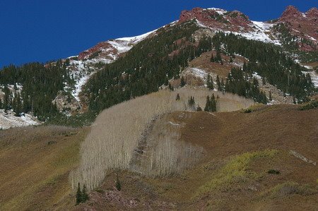
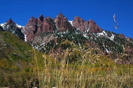
Here's "Vicki's Mountain" -- Vicki really liked this formation on the northwest side of the valley as you come in.

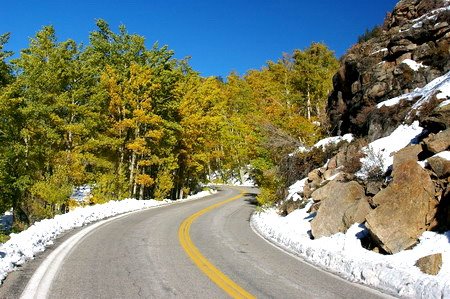
Highway 82 on the Aspen side of the pass.

I really didn't want to leave the Bells that afternoon. I wanted to sit and watch the sun set over them.

Glowing aspen over the pass.

Ok, I really have to stop now.....

Leadville Store, Sleep, Maroon Bells

(Sunday Eve, Sept 24 and Monday, Sept 25)

We came down off the pass and got into Leadville about 8:30pm, not sure what would be open. They had a Safeway that was open until 10:00. We bought some basic staples for the week -- milk, V8, eggs, bread, apples, soup, pasta, spaghetti sauce -- and beer and other stuff. We were looking for some sort of fast food on the way out of town, but everything was closing down. I suppose we could've gone to a bar. But we didn't. We got back to the cabin and had some sandwiches for dinner (hey, we had a big Waffle House breakfast and then Pizza Madness for lunch).

Gas in Colorado -- especially in the mountains, was $0.84 a gallon more expensive than it was when we left Columbia -- I figured it'd be higher, but not THAT much higher. But... that's the facts, and you live with them.

We got up and fixed breakfast the next morning. I had brought coffee and thick-rolled oatmeal from home.

Today, while we got used to the altitude, we were not planning any big hikes -- the plan was to go to the Maroon Bells and see them. So off over the pass to Aspen we went, with all of the associated ooh's and aaah's going over the pass. And then about halfway down on the other side, we came across a very pretty spot with sun shining through the aspen leaves, and the two Ansel Adams wannabes got out of the car and got busy with the digital film.

I got solar flare in a lot of mine, but I did get a few good ones without it.

On the way into Aspen we saw more aspens running down the sides of the valleys and I was itching to take a shot at them, but Sam was (wisely) saving morning time for the Bells.

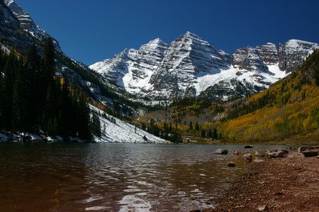
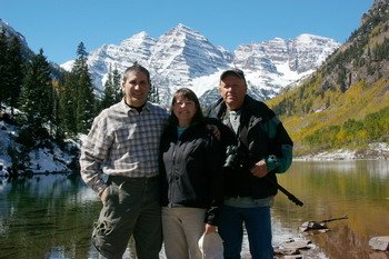
As it was we got there about 10:30 am, too late for the lake to be glassy still and get a nice reflection, and the nice morning "sweet" light and shadows. Still, it's really hard to take a bad picture of the Maroon Bells no matter what time of day it is.

For some reason, I thought that Crater Lake wasn't more than about 0.6 miles back. It's closer to 1.5 miles back, and it's up quite a bit. We hadn't brought hiking boots and we left our poles in the car (we'd never used anything but wilderness-made ones before, but I'd bought us some for some major hiking up and down mountains.) We set off without them, water, or food (mistake) and Vicki got her nice corduroys all muddy (after all, we weren't supposed to be hiking today). Along the way we heard this cacophony of laughter coming down the trail from the lake. It had to be a lot of people, and the closer they got, we realized they were children. The second grade class from one of the Aspen elementary schools was up there on a field trip. Talk about some cute kids! It was kind of neat, remembering being that age and what fun they were all having.

We got to Crater Lake around 1:00, and I spent most of my time fashioning a walking stick with my leatherman tool out of a piece of dead aspen tree out of a huge pile washed there probably by spring rains. It was for Vicki to keep her from blowing her knee out on the way back down, since we left ours in the car. But Sam gave her my monopod and she used it, so I used the walking stick (I left it by a sign my Maroon Lake for someone else to use, in the end -- and it looks like that's the thing to do because we saw several others later that week left that way).

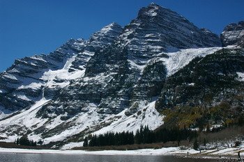
The rocks in the area are maroon colored due to iron oxides in the rock. The rock is different from a lot of the Rockies -- instead of the igneous rocks (formed from molten earth) this is old sedimentary rock heated and pushed up by the surrounding igneous rocks that make up so much of today's Rockies. I could actually see where this phenomenon started from Independence Pass from about 20 miles away (and shock of all shocks, I snapped a shot of it from there!) The slanting, layered rock in the background starting about halfway up the photo is where it starts.

Sam's memory cards were getting full, and we wanted a beer, so we stopped in this bar in Aspen for a drink. The music was getting on my nerves. It wasn't great atmosphere. So we looked for a Best Buy or a Walmart or something to get another memory card. Turns out you have to go to Glenwood Springs for that. But on our way to a Radio Shack someone told us about, we ran across a Wolf Photo. Perfect. For $6, they'd put your pictures on a CD in an hour. So we went off and found a burger and a beer at The Red Onion while we waited.

It took more than an hour. But we did finally get the CDs at about 7pm, and headed back over the pass, mostly in the dark (much to Vicki's displeasure).

Vicki has a bit of acrophobia and hates mountain roads with big drop-offs. Pass roads generally have these. Apparently this phobia is amplified by darkness. I was sure this would be the last time she'd agree to go over the pass with us on this trip. Fortunately, I was wrong. "As long as it isn't dark", she said.

We went back home, picked on the guitar, read, transferred pictures to the computer, and went to bed.

The Trip In. Colorado Springs, and Royal Gorge

(Saturday, Sept 23 and Sunday, Sept 24)

Got everything together the night before. For some reason, Vicki was very tired and for once I ended up organizing everything. Oatmeal, sugar & cinnamon, salt/pepper shakers, extra salt. Packed the stuff for trail mix, all the jerky. Got all my stuff together and was in bed by 11:30.

Unfortunately, I couldn't sleep. Vicki got up at 4:30 -- I may have had about 3 hours of sleep by that time. I was planning on getting up at 5, but since she had gone to bed at 9:00 ... anyway,it worked out. We got out on time and got to Sam's and picked him up just before 7:00 am. Stopped and topped the gas off ($1.99 -- won't be that cheap in Colorado) and took off.

My little FM transmitter that lets us play my mp3 player through the radio in the car died halfway to Kansas City. We stopped at a Wally World and got another one that cost about twice as much as this one -- and it worked great. Plus it lets you tune anywhere on the dial instead of just a few frequencies on the low end.

I brought my GPS with topographical info on it. Sam brought his with roadmaps, directions, and ETA estimates. Between battery chargers, cell phone chargers, my blue tooth headset, the MP3 player, the FM transmitter, my GPS and Sam's GPS -- not to mention his Nikon and my Pentax digital SLR's ... we figured we had enough technology in the car to get to Mars -- or at least maybe open a Best Buy somewhere.

We got to Colorado Springs at around 6:30 local time and checked into our Motel 6. We figured we just needed a place to crash -- and that's pretty much what we got. But it WAS cheap. They had "continental coffee" in the ... office in the morning. Whoo-hoo! And they had hot water, towels, and soap. What more do you need? Oh, I forgot about the 19" TV. Well, we got the Tigers score (we won!) and the Weather Channel. What a forecast!!!!!!! Pretty much Sunny all week except for friday.

We had our hearts set on Joe's Crab Shack for dinner. Vicki and I had eaten at one for the first time in Colorado Springs in 2001. It was fun. So we struck out to find it. We got bum directions from the motel staff (one exit too late). We knew there were two in Colorado Springs. And I knew the one they directed us to wasn't the one we'd been to. We had street addresses and tried to use the GPS, but Sam hadn't loaded street/direction data for CO Springs, so we were guessing. We drove about two miles past where we thought it should be and came back. Decided to go look for the one Vicki and I had been to downtown. But that exit was closed for construction, and we meandered around trying to retrace Vicki's and my footsteps from 2001 in spite of the construction. Finally, we stopped and asked directions at a gas station, and they directed us back to the one up north.

By this time we were pretty hungry. With sure-fire directions in hand, we struck out on 25 North. Got off at the correct exit this time. Drove past a Super WalMart and a few other places -- and there it was. Only something wasn't right. The sign wasn't lit up. And it was dark inside. We went around to the parking lot...

Closed for Rennovation.

Well, no Joe's tonight. We went to "On the Border" -- a Mexican chain we'd never been to before (and most likely won't go to again) and Vicki's and my meals alone came to like $48 (before tip). It was good, but it wasn't THAT good. But at that point we didn't care (much) anymore.

Back to the motel, and crash.

There was a Waffle House nearby, and we had a nice breakfast there with some interesting local color. Drove up the road a half mile to get a nice gander at the snow-covered Pike's Peak, and then headed down toward Pueblo to catch 50 into Cañon City to see Royal Gorge.

Royal Gorge, we all understood, was a tourist trap -- but one worth seeing once. Big wooden-plank suspension bridge you can walk, bike, or drive over (for $21 apiece). The bridge itself was pretty neat, and the canyon was interesting. The surrounding tourist trappings were ... lame. I mean, lame, lame. You expect them to be lame. This was really, really lame.

But then we went back into town to eat lunch at Pizza Madness, reccomended by Linn. It was good. Like, Sub Shop meets Shakespeare's (for those of you familiar with Columbia). The proprietor (or at least the manager) was an attractive middle aged woman who was working right in there with the wait staff. There were fiberglass (or paper machette) sculptures of bugs and aliens, and a very strange pizza-eating orgy painted on one wall. Good pizza & beer, then off again.

Frankly, Cañon City is only at about 5,000 feet. Here I am, a day and a half into my mountain vacation -- and I'm thinkin' it's about time to get some 'tude!!!!!!!!!

.....

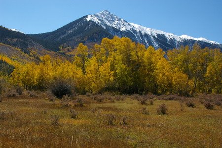
So we drove North up the Arkansas River Valley quite a while. We slowly gained altitude, and soon the Collegiate Peaks began appearing on the left. And much to my relief, we saw colorful aspen groves spilling down the mountainsides, and majestic snow-capped 13'ers and 14'ers. I wanted to stop and take a picture or two, but Sam was driving and he was all business. We were getting to the cabins. And it worked out just as well.

We got to the cabins around 5:00, and we moved in. Still too early for dinner -- we decided to head up to Independence Pass to make sure it was open. The signs on 24 said it was, but according to some confused motorists coming back down it, a sign further up 82 said it was closed. We figured the signs on 24 probably weren't lying, but there was one way to find out. (our first look at Mt. Elbert, from the cabins -- the peak to the right is it)

I was pretty happy about this decision. I love looking up at the mountains. I love hiking in the pines and aspens. I love sitting beside a rushing mountain stream. But I love nothing more than being above the tree line, in God's Country.

As we drove up the pass, I could feel that familiar euphoria building. Ever-changing, breath-taking scenery, and the road going up, up, up -- to that special place I can't explain to anyone who hasn't been there, and don't have to explain it to most people who have.

There was a lot of snow. I was hoping for an Elbert climbing attempt Wed or Thur, because the last forecast I saw showed some weather coming in Friday. I wasn't sure how deep it was above the tree line. I started to doubt whether a summit climb was possible. (note the lens flare in the picture to the left-- I got that a lot on this trip as aspen leaves look best with the sun shining through them. I need a huge hood for shots like this. Don't have one)

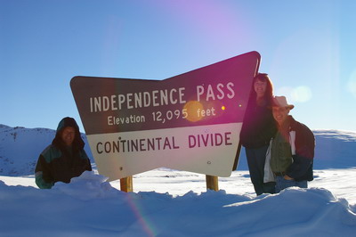
We got to the pass, and it, of course, was beautiful. 13er's and 14er's all around, snow everywhere, and a couple of frozen lakes. There was a short hike to a lookout point to the southeast, and we took off for it.

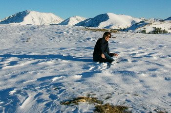
In places, the snow was more than knee deep. Vick's leg went way down once and she fell in it. It was typically about mid-calf. First big snow of the season, and a rare early one (for that much snow) for late September. Usually their first big one comes about a month later than that. The sun was setting, and it was cold. We needed some food for the week.

"On the day that John Wayne died, I found myself on the Continental Divide. Where do we go from here? Think I'll drive in to Leadville and have a few beers." - Jimmy Buffett, Incommunicado

And that's what we did.

(well, sometimes lens flare "works")

We're Back

We're back from our Colorado vacation. We went there a week, with Sam, and stayed in Balltown, right (literally) at the intersection of US 24 and Co 82. Right at the foot of the second highest peak in the Continental United States -- Mt. Elbert. Out our west and south facing windows, all we could see was Mt. Elbert and Quail Mountain, respectively.

The original plan was to go out camping in September in the Maroon Bells area, since I'd never seen them. It'd be on the cheap -- tents, food we brought, etc.

However, a quick look at the climatology data showed that it could easily be getting down into the mid 20's at night, and a quick check around for campsites along Maroon Bells road showed that they were all reserved. We could camp in the wilderness area, but restrictions required that we hike in at least 1.5 miles, just past Crater Lake.

That's a long way from the car on a cold night if you forgot something.

So we opted for WinMar Cabins -- mostly as a place that would be better than tents, and changed our plans to a Fall Aspen sight-seeing visit, a trip to the Maroon Bells, and a possible attempt on Mt. Elbert late in the week.

Well, Thursday and Friday snow fell above 9,000 feet, and a lot of it. 10 or so inches, and more at higher elevations. Reports that the aspens had started turning in early September combined with a report from a Denver news station that said for the best chance of seeing color one should go between the 10th and the 20th -- I was worried the Aspen Aspect would be a bust. To top it all off, I also read that early snows tend to knock the leaves off early. I was wondering if we'd scheduled our vacation about a week too late.

We didn't.

While the color MIGHT have been better the week before, the week before also had a couple of days of snow, a closed Independence Pass -- not good for sight seeing.

The weather was great. The only day were there were clouds to speak of (between Sunday and Saturday) was Wednesday when a cold front passed through. It wasn't that cold and there weren't that many clouds. Highs at the cabins were typically between 65 and 75, lows in the low 20's.

And the color was just fine.

Next several posts will, as usual after a vacation, be posted in order (reverse order as you read them from top to bottom), as if I had blogged them every day -- which I didn't. Stay tuned....