Tuesday, September 25, 2012

On to Silverton Ouray


Tuesday morning we slowly packed, and ate oatmeal and coffee.  But toward the end of breakfast we saw dark clouds and the fog of mountain precipitation coming over the ridge to the southwest, maybe a mile away.

If at all possible, I didn't want our stuff to get wet, or to have it raining in the middle of breaking down the popup and having the mattresses get soaked.

We scrambled.   We make a good team.   Vicki got things all put away and zipped up and out of the popup.  I got the stove and outdoor gear put away.  As soon as that was finished we took the covering off the popup, put the table and poles in the bottom, threw the mattresses on top, and folded the tent in and the two fold-out bed supports.

The rain was maybe 1/4 mile off now, and we packed the top of the camper, covered it with the vinyl tarp, sealing it as the first raindrops began to fall.  We hooked up the trailer lights and hitch to the car, and jumped in as it started coming down harder.

We stopped at the restroom on the way out.  It was raining pretty hard, but it wasn't far to run.

The idea was to take the ranger's advice and look for a place around Silverton.  Silverton he described as an old western town where they still had hitching rails on the streets, and they had the Durango Silverton Steam Engine.

It was several miles down the road before we started climbing into the mountains.   There aspens were beautiful even with the fog and clouds and rain.  Sometimes a sun even peeked through and really made it spectacular.  Before long we came to a pass and the rain turned to rain and sleet and even snow.   We were literally in the clouds at times.  Just under them at others.

I had to stop several times to take pictures, naturally.

The closer we got to Silverton, though, the less pretty the trees were.  At the higher elevations (9,300 ft), the aspens were finished.  I'm not sure any of the town's streets were paved.  It was rainy.  It was muddy.

It was cold.

We went into the Visitor's Center, which was a neat old house that had apparently been moved at one time.  They said it damaged the multiple fireplaces, so they could not be used.  But we had pretty much decided that it was not the pretty aspen grove we were looking for, and that it was way too cold.   Still, the Durango Silverton came into town as we were leaving, so we slipped to the far side of the Visitor's Center parking lot and I took a couple of shots.

As we headed down to Ouray (7,800ft) the leaves on the aspens reappeared.  The descent into Ouray took us along a road hugging the mountain on one side, and a deep ... pretty much a slot canyon cut by a mountain stream on the other side.  Breathtaking.

Around the last bend, and we could see the Victorian town below.  But to the right was  the Ampitheater Campground.  Pretty nice for a closely packed campground, but not exactly what I was looking for.  We bookmarked it and headed to Ridgway State Park, which the Mesa Verde campground host had talked up.  He said there was a beautiful view of the San Juan range.

But not today.  So cloudy and rainy, you couldn't see anything close to a peak anywhere, and Ridgway was down on the flat.   The KOA campgrounds along the way were tightly packed and completely out of the question. 

We headed back to Ouray.


We'd seen the Visitors' center on the way out of town right near the outdoor hot-spring swimming pool.  If we would have known.... we might have brought suits.

We told them what we were looking for, and the lady described a canyon up a road we had passed with two National Forest campgrounds.  Along a mountain stream.   She said the road started out a little rough but we should be able to get up it in the Taurus with the popup.   Ok.  Either there, or we'll hit the Ampitheater. 

The road WAS rough -- washboarded up the first hill and around the bend, but it smoothed out.  Dispite the rain, the dirt road was solid.  There were workers doing some drainage work and some grading on it.

The first campsite we came to (Angel Creek) was beautiful.  The first campsite I saw was stunning, right over the stream with an extensive stand of bright gold aspens.  It was also taken.

And the campground was tents only.

But we did determine that the season had ended the previous week and it was, until spring, a free, first-come, first-serve campground.

We continued up to Thistledown Campground, which had some sites that allowed RVs  ... and it was practically empty.  A tent, and a pickup camper, and a lady in an RV up at the far end of the campground.

We found a site, dropped the camper off, and headed into town to hopefully wait the rain out before we set up the camper.

Hit the Ouray Brewery.  Spent $38 on wings, a couple of beers and a sampler.  Not cheap.  But good.

The rain broke by the time we got back to camp, and set up the camper.   Soaked in a little mountain stream and aspen as the sun set, and went to bed.

Monday, September 24, 2012

Mesa Verde Day 2 and Four Corners

We had to be up early Monday morning to get to our 9:00am tour of Balcony house.   Vicki woke with a bad headache and had no energy.

We ate grapenuts and protein bars, and headed out to Balcony House.

It was cloudy, and there was rain in the morning forecast.   When we arrived at the parking area for Balcony House, Vicki just felt like she didn't have the energy to do it and wanted to rest in the car.  So I took the trip "solo".

 I was one of three Americans in the group.  There were 15 French, 15 German, a couple of Brits, and I think maybe a couple of Canadians.

Our guide, Paula, turned out to be the same lady who had sold us the tickets the day before.   Like Jo, she loved being a guide but they all have to do some time behind the counter as well.

This trip started out with a long flight of stairs down, a short walk along the side of the cliff, and then up a 30' ladder to the actual structure.   This was a colder location that didn't get as much sun, and it was built to be easily defended.  The theory is that this was a place where they stored a lot of their food, which, of course was very important.

It rained off and on during the tour, but never any sort of downpour.  And after climbing back out, I looked over to where the car hand been.  No Vicki.

No car.

She had driven to find a restroom, and had to do a whole loop to get back and parked in a different spot across the lot.  Whew.

We went on to the self-guided Spruce Tree House (accessible behind the Museum we'd been to the day before), and it was great to be able to spend as much time as we wanted just looking it over ... you're not rushed along as in the guided tours.  It WAS relatively crowded.  There was a Kiva there you could go down into, but it was rather busy and I was glad we'd been to Edge of the Cedars once again.  I didn't feel the need.

We exchanged playing photographer with an older couple, and decided to go to go to the park Cafe and Gift Shop.  Luckily, we got there RIGHT ahead of a tour bus.   They had something called a "Navajo Taco"  .... which was truly something else.  Lot of food, and good.  Ate, browsed the gift shop  - I actually found a silver/onyx inlay Kokopeli ring I'd been looking to repace an old one that never fit right.

Swung by the campsite and grabbed the propane tank from the camper.  Not really sure how much we'd used, but wanted to make sure we didn't run out tonight.  We headed into town, and found a gas station that filled bulk propane.   Turned out we'd used about half of it up to that point, and it was pretty cheap to fill it back up.  Filled the car with gas as well.

It was only about 3 in the afternoon.   We had originally planned on perhaps swinging by Four Corners on our way down to Mesa Verde from Moab, but cut it out of the trip as it was getting later in the day Saturday.  I knew we were within 60 miles of it, but I thought I'd punch it into the GPS and see how far it was.

38 miles.

That's a quick trip to Booneville back home.   We decided to go.

The road runs for a while along the edge of Mesa Verde, which rises from the plain on the left side of the road.  But the farther southwest you go, the more you see the kind of landscape Monument Valley is famous for.  Which shouldn't be surprising since Monument Valley is about another 40-60 miles down the road from Four Corners.

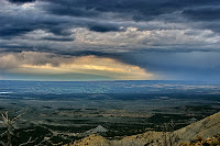
The weather continued to be a mixture of sun and clouds with long views to the south and west .   The sky was a dynamic canvas of clouds with dark, soft rain shadows falling from many of them.  Bright white where sun touched the clouds, soft purples where it didn't, and shafts of sunlight piercing through it all.

About where 160 splits off of 491 toward Four Corners is an impressive monument structure called Chimney Rock, a lone tower rising from the desert floor not far from the edge of the cuesta behind and to the east.

After the turn the road looked even more like a movie set with the black ribbon stretching out to the west, mountains to the north, and small mesas dotting the landscape.

The turnoff to Four Corners Navajo Nation Monument arrived unceremoneously, with a couple-hundred yard drive off the road into a parking lot.

I wasn't quite sure what to expect.  In my imagination, Four Corners would be in the middle of an extremely flat desert with little to no vegetation, and maybe a small concrete pad with a brass marker.

It's a pretty decent sized paved plaza.  Concrete, with brick colored concrete criss-crossing where the famous quad-border point is, and the names of the four states diagonally in stone in each 'corner'.  Therw are flags of the states and Navajo Nation all around.  There isn't much vegetation in the surrounding area, and the San Juan river runs nearby through the arid landscape, which actually isn't totally flat, but has mounds and mesas and little mini-canyons eroded out of the dirt.   Small colored rocks dot the ground ... some clearly had turqoise in them, among other colored minerals, but the backdrop was definitely desert beige.

There are four "buildings", lines of permanent vendor booths for Navajo artists ... one running diagonally in each state.  And in the center, the marker.

We ran into a group from Canada, one Greg Barnes and the group he was travelling with.  They had flown down to Reno Grand Junction (correction from Peggy -- another woman in the group after I emailed her this picture. Thanks, Peggy!) , I think, rented motorcycles, and were touring the area.  Pretty cool.   We traded photo-ops.  And Vicki and I went along and checked out the booths, about 1/3 of which were open for business.   There was pretty nice stuff there, mostly jewelry.  There was a pretty nifty knife one of them had chipped from quartz.  Some paintings and drawings.  I bought a brass road runner sculpture, and I bought Vicki some jewelry in addition to what she bought for herself and her mom.  These were clearly the best prices we'd seen on anything like this since the trip began as well, which surprised me.

About the time we were done shopping, about 5:00pm ... the vendors were closing down, a sight from across the parking lot caught my eye.  Sun shafts criss-crossing with rain shafts falling in the opposite direction.  I ran across the parking lot for a better shot.

I got a few pretty cool shots, and it did rain off and on.

We jumped back in the car to head back to Mesa Verde.   A rainbow appeared in the east, so I drove across the parking lot to take a few shots of it.   We left, marvelling at the sky and the sun on the desert landscape.   I had to stop and take some shots of Chimney Rock, the road going off to the west, and several other landscape shots.

And we booked back north to Cortez and Mesa Verde, arriving about sunset.  I took a shot of an amazing scene from Lookout Point on the way back to the campsite of clouds and rain over the plain.  We heated some leftovers, had a beer, and hit the sack.

For a last minute, in-again, out-again destination, it was definitely worth the trip, especially that day with the beautifully dynamic sky enhancing the scenery.

Sunday, September 23, 2012

Mesa Verde

I didn't sleep that well.  I toss and turn quite a bit at night, and there wasn't a lot of room for other positions.  Laying on my back seemed best.  I think it minimized the surface area pointing toward the nearby side wall of the popup, plus I didn't want to use up too much blanket -- you use more when you sleep on your side.   I was just barely warm enough, and I was ready go get up.

We got up at 7:00am and went for the quick protien bar breakfast so we could get on with the trip.  Word had it it is 20 miles from the campsite to Cliff Palace.   We wanted as early a start as we could get.

It's about half that distance to the visitors center.  It's a few miles from the park entrance itself to the campground, truth be told.  

We dropped by the visitors center where we would have to pick up tour tickets for guided tours of Balcony House and Clifff Palace.  Those and Spruce House were the only three open to tours, and Spruce House is an un-tickted, self-guided tour.

The lady ringing us up got the tickets mixed up at first ... I think we had two tours on the same day, or two tours of the same cliff dwelling, but a supervisor came over and straightened it out.   There's a little museum and gift shop in the visitors center -- honestly, if you have a chance to see Edge of the Cedars museum and you're interested at all in Puebloan history, do it.   But we needed to move off to our tour, still another 10 miles down the road.

Our tour started at 9:30 am.  We showed up at the parking lot, and down the trail about 100 feet there was a tourist souvenier booth set up with a lot of Native American Flute music (which I love, and have quite a bit of already) and water, and park-related trinkets ... which we passed right by.   We were still filling water bottles from the 2.5 gallon water container in the trunk and getting by fine.  


We meandered down the trail to where the people for the tour were collecting, and our guide -- a wonderful, entertaining, funny, and yet serious (with the discipline, rules, and reverence) Park Ranger whom I'll put up for an award any day ... "Ranger Jo", who I think is Jo Schrock - has to be.  Not every Park Ranger can be a Ranger Jo.  But she sure sets a standard to which they can all strive.

The K-r seemed to be working again before the tour. I took a few shots with it, but it started acting up again after several shots and I had time to take it back to the car and come back.

Ranger Jo gave us a fine tour -- you almost forget that you don't really get to go into any of the dwellings ... of Cliff Palace. 

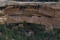
Some of the walls had been restored, apparently, by a Sweedish archaeoligist (Gustaf Nordenskiƶld) and his crews back in the 1920's, but the rest of it was still in remarkable shape, and it was very easy to imagine anient Puebloans wandering through the place, grinding grains, baking breads, having ceremonies.  Ranger Jo had stories to tell, a few from a friend and former Ranger who was Hopi herself.

One story was on the question of why the Anasazi left in the late 1200's.   They had no written language.  Nobody knows for sure why.  But her friend, when asked, said simply, "it was time".

The elders probably decided at some point, and that's probably all they told the people.  It is time.  They believed in signs, if you listen to Puebloan lore.  It may have been as simple as the cliff rock shifting that spooked them.  Or it could have been climate change that limited their ability to grow the crops they needed to sustain the community.  Tree ring data shows a long, severe drought that coincides with their departure.  Or ... there was apparently an influx of people in the few hundred years leading to the end.  Overpopulation could have been a problem.  Wood from cedars was more and more scarce as they used them for structures and firewood.  And an influx of people may have caused political problems that tore the community apart.

Bottom line is we don't know.  They left, and among their descendants are the Taos, Acoma, Zuni, and Hopi.

After the tour we drove around the rim of the canyons looking in the cliffs at various other ruins.  We went into a shed built over an excavated pit house to demonstrate how most of the people on the mesa actually lived.  We found a picnic area and had peanut butter sandwiches.  And then we headed into town to look for a new heater.

I half hoped we could find a place that would take ours on a return, return it to the company, and that way we wouldn't have to shell out another $100 on a heater.  Neither of us wanted to spend another cold night like last night, though, so ... whatever it took.

The Walmart in Cortez did not have the Little Buddy heaters in yet ... we were a bit early.  But they sent us down to Big R, a farm and ranch supply, where we did find one which we had to out and out buy.  So we did.  And on the way back to the campsite we stopped at Mesa Verde Pottery on the East side of town and browsed about.  Lots of jewelry in there, sculptures, and clay things. We ended up buying three clay pots and I think I bought Vicki a neclace or something... but I can't remember what.

We headed back into the park, and I figured we had time to hit the museum over by Spruce Tree House ... Wow!   This is a nice museum as well.  We sat through a film on Mesa Verde and really took our time going through it.  They had hand tools and stone tools and twine, clothing, art, pottery, miniatures of villiages and houses, examples of the grains they grew.  Quite impressive.

It's also a little town, in a way, up there.  It has its own post office ... I think perhaps for the rangers and there are a couple of pueblo houses there where some people actually live ... clothes lines, satellite dishes ... we got a post card to mail to Trenton as well.

Back to camp to make dinner, take a shower, and hit the sack.

We drove to the store where I got some ice and a little beer, since we'd thrown most of what we had brought into Ray and Donna's cooler the previous night.  No biggie.  It wasn't that much.

It was the first shower I'd had since leaving Olathe the previous monday morning.  I had had a few river baths in the Colorado river, washed my hair a couple of times in bathrooms, and used large body wipes that Vicki had bought to use when facilities weren't available.

A shower was very nice.

Vicki whipped up a chicken and rice meal to which she added canned chicken and some mixed veggies.  It was pretty good.   Iced down some beer and had one.

We lit the new heater and turned in for the night.

After a couple of hours, it went out.

Same thing.  Couldn't seem to light it.  This one, too.  The gas was blowing the flame away from the base of the pilot.   I aired the popup out again, and tried again.  Still the same thing.

So I pushed the end of the lighter down to right where the gas was coming out.  It lit.   So we cracked the windows a bit more.

At that point I knew there was probably nothing wrong with the other heater.  Oh well.  Live and learn.

It turns out, I think, that the first night we used it I was so paranoid about carbon monoxide that I left the windows zipped down significantly.   The night we used in Moab, it was on low all night.  The carbon monoxide meter never got off of zero at any time ... so I had more confidence and closed up the windows more the last two nights.  Well, this starved the popup of oxygen, and there is a safety oxygen meter on the heater that shuts it off if oxygen starts to run too low.  So apparently, we need to keep a significant amount of ventillation going for just that.   The rest of that night, and for the rest of the trip, we left the windows open like we had the first night, and never had a problem again.

Oh, and I tested the first heater.  It works fine.

Saturday, September 22, 2012

Edge of the Cedars and Hovenweep

We got up at 7:00 am Saturday morning.  We really appreciated having organized so much the day before.  It made breakdown that much easier.  Put everything we hadn't already packed into the car out on the picnic table.  Ate some grapenuts with that handy milk you don't have to refrigerate.  Brilliant move by Vicki.

A man who had had to camp across the road overnight asked if we were leaving and if he could have our site.  I said yes, we're off as soon as we get packed up.  We were getting pretty good at it.
Once again, the vinyl cover for the camper was cold and didn't quite stretch all the way over the back.  The trick for that is to get it out in the sun down the road a bit, and then pull over and stretch it out.

We drove through Moab and headed out on the open desert road.   Not terribly far down the road is Wilson Arch, which I didn't know about.  I pulled over to take a picture or two and stretch the tarp over the camper.  I had left the camera on 3200 speed from the night before and forgot about it.  I hate when I do that. The pictures ended up turning out lousy.  We also drove by a tourist attraction called "Hole In The Rock".  Didn't know what it was, and wasn't that interested.

We were headed to Mesa Verde, and planning to stop at Hovenweep Monument along the way.  We had Puebloan ruins to see.

As we got closer to Blanding, we kept noticing signs for an "Edge of the Cedars State Park".  The landscape continued to be that harsh, uniniviting, semi-barren, waterless expanse of scrubby cedars and ephedra.  Who would want to have a picnic out there?  But as we got into Blanding, we saw signs for a visitors center ... I think it mentioned Hovenweep and Edge of the Cedars, so we stopped there.

Glad we did.  It was a nice visitors center with some artifacts displays and re-creations of frontier life in the Utah Desert.  I asked about Hovenweep, and the lady there said if we were going to Hovenweep and Mesa Verde, we just *had* to go to Edge of the Cedars, which was only a few blocks away (I thought we had passed it several miles back).

Turns out it's an Indian ruin as well, with an impressive museum of Puebloan artifacts from around Utah and Colorado.  We drove the few blocks through Blanding to it.  Oddly, it was at the end of a suburban style neighborhood.  Seemed so out of place.

The museum was great.  We probably spent over an hour just going through it, looking at pottery, weapons, tools, clothing ... turkey feather blankets (fascinating -- and brilliant) reading about how they were found, how they were made, and how the modern Puebloan people still have these things in their history and know how they were made, Puebloan culture, Kivas, Kokopelli ... Then right before you go outside to see the ruin, there's a large room with glass windows in the walls showing shelves full of pottery, and a computer database you could browse through in the hallway while you looked through the window to tell you what you were looking at.

After looking at a display talking about the various incarnations of the Kokopelli figure and how ... we mostly have it wrong.

We went outside.

It was a small community ruin, with no above-ground roofs intact, but the Kiva had been fully restored ... and they let you go down in it.  There were very few people there - so we got the place to ourselves for quite a while.

But we really did need to move on to get to Hovenweep and eventually Mesa Verde.
So we got back in the car, and headed to Hovenweep.

Hovenweep is on Navajo land. There are signs on the road that tell you you are entering Indian Nation land.   You see lone houses, very sparse.  And some in clusters.  Very depressed.  Sadly ... kind of trailer-parky. 

Don't take this the wrong way, I am fascinated by Native American Cultural History - but it is very sad what these people have become if this area is any indication.  You can almost tell when you've entered Indian land.

You remember the old commercial where someone throws some trash out the window and there's an indian standing by the side of the road and a tear rolls down his cheek?  Well, sadly, it seems the roles have been reversed.  When we entered Indian lands, the first thing we noticed was a marked increase in roadside litter.  Fast food containers, soda boxes, beer cans and boxes ... I chalk it up to depression.

We pressed on, past the Hatch Trading Post, starting to wonder where the heck this place was, but the GPS insisted it knew the way, and I have found it to be trustworthy.

When we got there, we found that since it was a National Monument, Vicki's lifetime National Park Pass got us in for free.

Woot.

It was pretty warm.  The ruins themselves basically ring a canyon, and the 2 mile trail goes around the rim of the canyon, ending in a descent to the bottom and a hike back up.  Most of the buildings were round and square "towers" and structures much like the one out in the middle of the desert at Edge of the Cedars.  The surrounding landscape is scrubby desert vegetation.  At the head of the canyon was slick rock and the surrounding mesa drained to it.  It must be a spectacular waterfal when it rains, and imagine they got water from the bottom of the canyon during drier periods.

After stopping at Edge of the Cedars and spending an additional 2 or 3 hours here, we really needed to move on to Mesa Verde and get a campsite and set up the popup.

Hovenweep is practically in Colorado - I think the National Park office that operates it is, in fact, somewhere around Cortez, which is the gateway to Mesa Verde.   We headed northeast into Colorado making it maybe five miles instead of the mile and a half into Colorado if we were flying.    I think it was about 20 miles to 491, and then we cruised toward Cortez, and caught 160 east to the park.

As we got closer, we could see fingers jutting out from the "cuesta" (mesa verde isn't actually technically a mesa) in the distance even before we got to Cortez, and it was maybe 10 miles from there to the park entrance.

The actual entrance to the park is several miles from the store/gas station/laundry & showers, and it's a couple of miles past there to the campground loops.   I thought we would have an assigned campsite, but we didn't.  We had a reservation, but the reservations are first-come first serve.  We looked through the loops.  We could have shown up a bit earlier.  Not surprisingly, the nicer campsites (the ones with decent sized trees on the west side) were taken.  There was a handicap campsite right across from the bathroom that had nice trees ... but, of course ... we're not.  And there were some well-protected tent sites, but they weren't for trailers.  Our little trailer, small as it is, is considered an RV.

We ended up picking a spot for the trees by the picnic table.  Had we known the fire pad was not actually a fire pit, but a grill for charcoal that you couldn't tip up.  We'd've picked the next one over.  But we didn't figure that out until later.

We started to set up, and the campground host/ranger came up in a golf cart -- turns out he was fascinated by our popup and wanted to see how it went up. 

He was a retired jeep trail fanatic and knew the surrounding area well, including the Silverton/Ouray area.  We had quite a talk about possible campgrounds up that way after we left Mesa Verde.

Ray &  Donna from Chicago pulled up in the campground next to ours with a fire ring.  They were quite friendly, offered us beer, started a fire and we spent the rest of the evening with them.  Turns out their daughter went to Mizzou and works at in TV news in Kansas City somewhere.  And it was Ray's birthday, to boot.  I remember camping as a kid and mom and dad kind of making friends at campsites.  This was kind of like that.   If they had been there more than one night, we might have gotten to know them better and exchanged emails or something.   We had a very nice time with them.

There is also free wi-fi in the campground.  When we finally turned in, I got on the internet to update our friends on our trip.   It was also getting pretty chilly, so I turned on the heater.

It ran for about 30 minutes and stopped.  And I could not re-light it.  The gas flow kept blowing the flame from the lighter away from the pilot.

It was going to be a cold night.

I remembered we have a small propane "survival cat" heater in the trunk for winter emergencies.  Not nearly as powerful as the Little Buddy™.   I put some mylar emergency blankets up on the ceiling and in front of the door to reflect the heat our way, and we slept in the same bed for warmth on top of that.  Those beds ARE pretty small ... I was on the inside since Vicki is more clostrophobic than I am.  I couldn't move much.  Didn't sleep well, either.   It got cold, down in the 40's in the popup.

But we didn't freeze. 

Tomorrow, I would have to see if we could find a new heater down in Cortez.

Friday, September 21, 2012

Moab

We slept in. 

Got up, and I made some oatmeal.  While that was cooking, we started organizing stuff to overcome 3 days of entropy and make tomorrow's breakdown and packup easier.  

I put too much salt in the oatmeal .... I choked it down, but Vicki couldn't and had granola and protein.

I asked the campground host if he knew of any place in town that did car glass dings.  He didn't, personally (I think he's from Minnesota and this is a fall gig for him) but he sent us to a garage that he was sure could reccomend someone.

Sure enough, they told us Rick's Glass was on the south end of town, and we cruised through town to the south end and found it.

He said it'd be $35 (which I expected) and about 20 minutes (which I also expected).

There was an ALCO ... a bit like a cross between a Dollar General and a small Walmart just about 100 yards away, so we decided to go putz there.   Vicki ended up getting a couple of tops.   I found a white wicking microfiber shirt ... that'll be cooler in the sun.

Went back and picked up the car.  You can tell where the ding is, but it's repaired as well as it can be and won't crack any further.   Now ... to find a laundromat.  We'd seen several in town on our way through a couple of times.   And there was one not too far from the Alco store.   We went in, taking the laundry soap we remembered to bring with us.  I've learned from past camping trips that laundromats really ding you on the detergent.

Vicki set about putting the laundry.  We needed some hangers, so I went next door to ... I think it was a Dollar General and bought some.  Came back in with the laptop and connected to the internet via my phone.  Time to copy some pictures off the camera cards to the hard drive, and maybe say a few things on facebook.   We ate some sandwiches and apples while we waited.

About the time the laundry was done, so was I.  We packed up the laundry, and started walking up and down the main drag looking at touristy shops.

I ended up getting a nice pair of flip-flops and some really pretty thirsty stone coasters ... but my big buy was a Minnetonka Aussie hat.   I've been looking at those in Eureka Springs for years when we've been down there in the fall and winter, but they never have my size.  But these guys did.   Vicki bought some sandals as well.  I bought some jewelry for her she liked.   A few other little odds and ends.  And she bought me a nice Life is Good shirt with a guy playing guitar.
They had a Life is Good flag at that store.... I knew I wasn't crazy.  It WAS Jake, hiking up a mountain.  I'd seen the same one in St. Charles, but I could never find the shirt.  I found Jackie hiking up a mountain, and Jake hiking on flat ground, and with a dog.  But no Jake going up a slope.  Maybe they only made it on a flag.  Dang.  I'd really like that on a shirt.

I didn't take many pictures in Moab.  It's not a terribly photogenic town.  Quite utilitarian ... no frills.  Like the kind of people it takes to live in this harsh landscape and climate.  But a nice enough town.

I ended up talking to a shopkeeper about the Umtra Energy Project and what it is.  Apparently, there used to be a uranium processing plant here, and the pilings from the processing were buried on the north end of town.  I'm assuming the EPA decided it was too dangerous, and the project is now ... moving all that rock and dirt ... an unimaginable amount of it... farther away from any populated area.

It was getting toward 5, and still a little warm to go back to our sunny campsite in the hot canyon, so we stopped by the Moab brewery where I had a Dead Horse Ale and Vicki had a Bicycle Chain Brown Ale, and we split some nachos.   After about an hour we headed back toward the canyon.  We stopped at the head of it at the pedestrian/bicycling bridge over the Colorado we'd driven by every day.   I took some river shots and a few sunset over the canyon shots.  Walked right up to the north canyon wall, which is pretty much vertical from top to bottom ... no rubble slope near the bottom like in most other places.

We headed back to camp and organized a bit more.  Started a fire.  Cooked a couple of steaks we'd bought at the grocery store.

And roasted some marshmallows.  Played a little guitar and talked.

After dark I decided to try taking a picture of the canyon wall to see what I could get.  Nothing but black until I opened up a time exposure to 30 seconds at 3200 speed.  I got some grainy, but otherwise pretty cool shots.

Off to bed.   It was supposed to get down into the 40's that night.  So we ran the heater on low just to keep the chill away.

Thursday, September 20, 2012

False Kiva

A typical Canyonlands view.
The drive from Upheaval Dome to the False Kiva trailhead is a short one.   But you have to know where it is.   False Kiva is considered a Class II archeological site.  I think it means it's not super important, but all the same they don't want a lot of traffic going through it.  So it's not on any park maps, and there's no labeled trailhead -- and if you ask a ranger they are supposed to tell you how to find it.

On the trail to False Kiva.
I had done a little research ahead of time, even going so far as to talk to a guy who had been there.  He didn't want to post the instructions for all to see, but if you emailed him he said he'd send you the coordinates and some instructions.  Which he did.   I won't post them here for the same reasons.  But you can find out how to get there with a little diligent web searching.

We were to park in a little pulloff on the east side of the road.  I'd seen it on a sattellite picture and I also knew approximately where we were.   The GPS coordinates weren't quite jiving with mine down to the thousandth, but there was only one pulloff.   We walked a couple hundred yards down the road and found the unlabled trailhead and started walking down the wash toward the canyon.  It was about 5:00pm.  The sun had been setting around 7:00pm.  Two hours.

In my zeal, I had forgotten a couple of important things.   One... my headlamp.   Two... my super-wide angle adapter.   And I grabbed a camelback for water ... not knowing that  it was Vicki's and that she had removed the bladder.

I didn't realize any of these things until we were well on our way.  

Thin layers of sandstone.
Vicki was a bit nervous about the timing.   It wasn't an OBVIOUS trail in many places, but it was very well marked with cairns -- surprisingly well marked.   I knew the drill.  Hike to the cliff's edge to the south of it, look up north and see the hole, and hike down a pretty rough "trail" with some boulder scrambling, below and past the hole, and then back up to it.  It was reportedly maybe a whole mile hike.   Shouldn't take long.

I knew Vicki was tired and done with hiking after the hike to the granaries.   But I told her my thinking.   She's tired.  Heck, I'm tired.  We need to get some things done in town tomorrow.   It's a bit of a drive just to get here, and then spend the time and go back.   And ... tomorrow would be a nice day "off".   And we're here.  Now.  And the sun is setting.   Any photographer knows about the light at sunrise and sunset.  This is a perfect opportunity, and I don't want to waste it.   The long views at Canyonlands have been disappointing because of the smoke ... so ... if you let me do this now, tomorrow we'll fix the windshield, do some laundry, and putz around in Moab ... hit the tourist shops.

False Kiva Hole (I didn't take this
one ... I had neglected to take this
shot as I was in a bit of a hurry.)
She went along.   But I could tell her heart was far less than "in it".    But one thing I did remember to bring is the walkie talkies.   I told her when we get to the edge, if I decide to head for the "cave" and she doesn't want to, I'll leave her at the edge with a walkie talkie.  She can watch the sun going down with a pretty spectacular view, and I'll go ahead.   She'll be able to see me all the way.

We got to the edge... it's hard to call it a canyon because it's vast and there's nothing narrow about it ... but I guess it technically is one ... and I showed her where I was going.

Me at False Kiva.  Had to adjust the
brightness so you could see me.
Too much backlight, no flash
"Why do you have to do that?"

There's some things you just can't explain.  Two things, here.  1) not everyone who comes here even knows it's there.  You're kind of in a "club" if you've been there.  And 2)  It nicely frames photos of the canyon.

"You don't have to go.  I will go by myself and I won't be long."

It had only taken us about 40 minutes to get here, and I left her there.  She didn't want to go.  I scrambled down over rocks and boulders and slickrock and scree, up under a cedar, across and below the kiva.   We saw a man up in the cave, and we commented on it over the walkie talkies.  But I pressed on, up the slope from the northwest and into the cave. 

German photographers, waiting
for sunset in False Kiva hole.
There was a group of 4 German photographers there, cameras on tripods, waiting for sunset.  I greeted them and looked around at the False Kiva itself, taking some shots of it, and trying to frame a good wide angle shot with the edges of the cave.   But I couldn't get the whole thing.  I should have brought my 0.45 adapter.   :-(

Having seen other Kivas, I could see why this one's "authenticity" might be questioned.  1) it wasn't built down into the ground, and 2) no mortar.   I could see why one might consider this a sacred place and start to build one, though.  Or maybe someone was going to start a cliff dwelling here ... still ... no mortar.

My best False Kiva shot.
Still, it was worth it just to have made it there.  But Vicki wanted me to hurry back, and I didn't particularly want to leave her sitting there long.  It had only taken me 10 minutes to get here from where I left here, and I spent about 10 minutes in the cave.  I started to leave, but thought ... wait!  I need a shot of me here to keep ... and to show Megan Owens, who has been lots of places I haven't, but this is a place I know she wants to go that she hasn't been yet.   Fortunately, Germans know English, and photographers often reciprocate photos anyway .... they took a photo for me with my camera, and I scurried back to Vicki.

Overhang and red rock protrusion
at False Kiva.
She'd been marvelling at the veiw, and especially at the giant red wall of sandstone in front of her.   I knew she was worried about it getting dark.  Frankly, I was a little concerned myself, but I wasn't panicked or anything.  If it got dark, it got dark.  I knew the lay of the land and which direction the road was.   We'd be fine.  Might be a little harder after dark, but we'd be fine.


The light on the surrounding landscape was now ideal, and I of course snapped what I could while walking.   As we climbed out of the wash and toward the road, the sun was pretty low on the plateau, and the sunset was spectacular due to the same smoke that limited our views.  I actually got a few good shots of it, the last one showing purples and pinks .... almost surreal.

We got out to the road, got back to the car, and drove straight out of the park.  It was just getting dark.

This is why photographers love
sunset.
It was completely dark by the time we got to the turnoff to dead horse point.  We could see bright light coming from a place on the horizon ahead ... couldn't figure out what it was. 

And later we saw another down off the plateau as we were heading down it... turns out it was gasses burning off of oil drilling operations.  Giant flames of natural gass just burning.  Going to waste.  But that's the way it goes, I suppose.

 I did NOT feel like cooking, eating, and cleaning at the campsite after dark and after what had been a pretty long day.   We got into Moab about 8:30pm and hit a Denny's.  It was freezing in there!  I kinda felt dirty and gritty, but I'm sure they see a lot of that there.  We ate, went back to the campsite.

The smoke was good for something.
Probably responsible for some of
the richness and unusual colors.
I went down to the river and stripped down to my boxers and dove in.   Cold.  But refreshing.  I splashed around and scrubbed a bit.  And I felt clean enough when I got out.  A thousand times better.


Back to the campsite.   And to bed.