Friday, August 31, 2007

The Longest Day, Part II

More Tuesday, Aug 21

In my pack, as any good mountain hiker would, I carried some extra layers. In all liklihood I wouldn't need them today, but if you only prepare for liklihood up here, you could very well end up one of the dead ones. Hypothermia is nothing to scoff at, and the mountains make their own weather. Today the mountains would have a much harder time than usual making wet weather or lightning, but you should never take it for granted. I don't.

One of those layers was my white microfiber compression shirt. These are nice because they wick sweat right away from you and facilitate its evaporation, keeping you dry -- plus they do provide some extra warmth. But what I needed right now was a compression bandage, something I will carry on all such future trips. I had a fleece layer and a waterproof layer, and I calculated that doing something about the knee was more important than having the compression shirt. I decided to do a "survivorman" type video of my McGyver moment.


First I thought that since the sleeves were pretty small, a single sleeve might provide the support my ligament needed. It hadn't gotten any worse, but I didn't know how much of that was the ibuprofen talking. My guess is that this is a stabilizer ligament, and it just needs some extra help with the stablizing. A quick Google search turns up that it's my Tibial Colateral ligament, and yup, that's what it's for, so I guess I was right. At any rate, I cut a sleeve off with my sheath knife and put it around my knee. It was not nearly tight enough. So I went to cut some ribbons of the shirt to use as an ace bandage. Ultimately, I couldn't get one long enough, but I tied what I had around it anyway. I also took a little shred of the shirt and used it as a cord to attach the leather strap of my hat to the breast strap of my backpack. I used a plastic clip I had found on the trail earlier as a clip that could be undone easily. And of course the main reason I did this is with the ~35mph wind easily able to blow it off and me approaching a part of the climb that sported 600-1,000 foot dropoffs... I needed that hat, and that's no place to go chasing one. I didn't bring a spare.


The bandage wasn't helping that much. The climb from the boulder field to the keyhole was more "up" than I thought it would be. With my knee giving me a mild pang every time I bent it past about 25 degrees, it made it more difficult than I would have liked. At this point I was basically "limping", using my hiking pole to minimize the extent to which I had to bend my knee.


I caught up with a german lady, maybe in her late 50's to about 60, who said "my knees are shot, my ankles are shot, my hips are shot, and I can do it. You'll make it". In the end, I have to wonder if that woman's goal was the keyhole and she didn't know mine was the summit, because she didn't go past the keyhole. I got a lot of encouragement from several people on the way up who asked me if I was ok. One man back by Mt. Lady Washington told me this was his 7th time and that it wasn't dangerous. Every little bit helps.

I would have liked to have someone take my picture by the Agnes Vaille Memorial Shelter just to the left of the keyhole itself, but frankly it was too crowded and I wouldn't have liked the picture. There was a pretty young Ukranian or Russian lady sitting behind a boulder right underneath the keyhole. I stopped for a minute and made a little small talk. She said this was the end for her. It was too windy in the gorge on the other side.

Well, this is it. I'm here. The knee doesn't hurt too bad. I'll keep a close watch on it and if I make it up the trough I'm probably good. Plus, I have to check out the other side if only to scout it out for a future attempt. I could at least do that.

Up and through the Keyhole I went at about 8:25 am.

The west side of Longs Peak was gouged by the huge glacier that carved out Glacier Gorge -- one of the more popular attractions of the park. Long itself, from this angle, is just the largest of a series of teeth that line the ridge of the east side of the valley. As a matter of fact, last time I was in Glacier Gorge, I didn't even realize I was so near the mountain. Only after I got home and looked at the pictures did I recognize its distinctive flat top in the background of some of my shots.

It's a good 2,000 to 2,500 feet to the valley floor from here, and the west side of the gorge is in shadow. It's going to be a bit cooler, but I'll be working hard enough to make up for it.

The first challenge is a section called "The Ledges". The ledges aren't as bad as they look in pictures, although carelessness here could get you killed. If the wind were too much stronger, I probably wouldn't have risked it. And there is one particular spot which I'd seen on a YouTube video where there are two iron bars driven into the mountain to be used as hand and foot holds, and they were most welcomed. A fall from here would likely mean at least a rescue, if not a medivac, and the trail jogged at this point meaning it was basically down to maybe a foot wide for few feet. But all it takes is paying attention and a little care, and you're over it and on to a much more generous path the rest of the way to the trough. This doesn't mean you don't have to climb up and over several variations in elevation, but that was about the scariest part of the ledges.

The ledges trend basically downward toward the trough -- a little disheartening since that's that much more altitude you'll have to gain in the trough, but it's really not too bad. The knee was no worse than it was when I was hiking through the tundra hours earlier. I was slightly concerned that I'd make it, get back down, and my knee would swell to the size of a canteloupe by the next morning, but I kept telling myself "it's not that kind of injury".

All accounts I've read say the trough is the most discouraging part of the climb (although I'd read a couple of accounts that your first look at the homestretch could be pretty daunting.) You gain about 800 feet in elevation in a pretty steep scramble over a lot of loose rock -- although it's not all loose rock. There is a bit of slipping and sliding involved. But nobody was starting any rockslides of any substance, and I did my best not to cause any of my own. Occasionally someone would yell "rock! sorry!" but I never actually saw a rock threaten anyone that day.

Keep in mind as you look at the picture to the left/above, this is from the bottom of the trough, and there are probably 20 people in the shot. Some are coming down, some are going up. It's kind of hard to give a good idea of scale here. But they appear as little dots and they're clustered near the top. Well, they're not as near the "top" as they look. I'm using "top" here in reference to their relative position in the photo.

My steps were getting pretty deliberate by now. Take one foot. Find a good foothold a bit higher up than you are. Use your leg to left you up to that level. Use your hands and other leg for balance. Repeat. I just tried to keep moving -- resting only by moving very slowly. Never stoping. A few people continued to pass me. I had thought the hiking pole would be more trouble than it was worth in the trough, but frankly, with my knee, I needed it to help keep the strain off of it, and it worked pretty well.

The guy who had told me it wasn't dangerous and this was his 7th climb -- recognized me as "Missouri" ... on his way back down. "Hey, Missouri, you made it!", he noted. He seemed to be genuinely congratulating me, and encouraging me at the same time. I don't think he'd expected me to get past the keyhole with my knee injury and my slow pace. He said I should be at the top by 11:15. It was 9:30 -- a little over an hour after I'd popped through the keyhole.

I decided to stop and eat a little more. What you need while hiking and climbing up here is energy, and I hit my trail mix and more dried cranberries, followed by a little jerkey to help all that last just a little bit longer. I was saving the Mountain Goat bar from Two Brothers for the summit. My water was holding up fine. But I was having to blow my nose a lot -- I don't know if it was the dry air, the coolness of it, or something in it. But my nose was getting kind of raw, and my pocket was filling with kleenex.

As I approached the top 1/4 of the trough, I noticed a familiar dress coming down the mountain. The Mennonite lady and her party. I snuck a picture in. It's just too good a story. A girl in a dress had summited. Beat me to the top. Passed me on the trail, summited, and was on her way back down long before I got there.

This is not a race.

Later it did occur to me that I have no way of knowing if she actually did summit. She may have gotten to the homestretch and said "nope". But somehow, I doubt it. I have no reason to believe she didn't make it up there (I think the guy in front of her there was in her party as well).

I'll tell you what. I've always said I'm a big fan of girls who aren't ashamed of being girls. And an even bigger fan when they're up to a challenge like this. Do it in a dress, and I'm quadruply impressed. This one definitely earned, as Vicki would say, her Bozo Booster Button today!
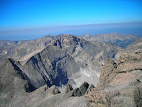
I reached the top of the trough at 10:22 am. There was a bit of a tricky part near the top. I looked it over and saw the way people were trying to get up to the right, which was possible for tall enough people with a bit of effort. But I could see a better, non-obvious circuitous route which was much more manageable. I think people don't see it because you appear to be backtracking by going that way. Well you are, but only about 15 feet. Much easier.

I stepped over a ledge at the top of the trough and whacked my knee. Ow! It suddenly hurt much worse. I realized my dose of ibuprofen .... the one I'd taken sometime after 4:00 am, was probably about worn off. I dug in my pack and got out my first aid kit. I had 4 ibuprofen left. One dose for a person my size. One guy stopped and asked if I was ok. I explained my situation pretty in a matter-of-fact manner, and he asked if I needed any Advil. I told him I had a dose for right now, but I'd really like to have one for the return trip. He gave me the four I would need. I think these were the same people that lent me the real live Ace bandage, Sarah and Mike Miziorko from Minneapolis. Thanks! I think I'm going to make it. I never thought of carrying enough ibuprofen for an inflamational injury on the trail. I will carry 16 from now on.

The next section between the trough and the homestretch is called the narrows. If the ledges didn't scare you, this just might. The drops were much more sheer, and the trail not nearly as wide in the beginning. But there were plenty of hand holds in the rock face of the mountain, and believe me, I used them.

Right at the beginning of the narrows on the southwest face of the mountain, you look down into this large pit, and quite a ways down is a large black rock that sort of resembles a hearse burried half way up its hubcaps in loose rock. Not surprisingly, it's called "the hearse", and I'd say of all the falls you wouldn't want to take, this would be the one. Again, it's hard to estimate distances, but this one was ... hundreds, if not 1,000 feet, and mostly just ... down. And a hearse waiting right there to pick you up. How handy.

A few people die on this mountain every year. This is the least dangerous approach, but it's also the one most people take. A small percentage times a large enough number yields a significant result. Today, I think somewhere between 30 and 50 people summited. On a late summer weekend day it would be three times that many, weather permitting. The most recent death I'd heard of was a guy who did not turn back due to bad weather. He was too close to the top to want to turn back, and believe me I can empathize with the drive. His friends turned back. Rescue found him later. At the top. Frozen to death. Jennifer made sure to send me that one. Thanks!

A few years ago a Japanese guy was blown off a ledge by high winds. Was it here?
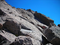
Time was kind of in suspension by this time. It's kind of the same zone I go into in a long drive -- I don't pay much attention to anything but this moment, so the feeling of long periods of time passing kind of goes away. Don't ask me how I do it, I think it's a defense mechanism. It just happens. I don't remember much about the rest of the narrows ... only that they went generally down a bit and didn't seem to be very long. (I was right -- less than 20 minutes) And then there it was. The homestretch.

I think.

I'm going up that?

Yes-I-Am! The odd thing was that I could only see a very few people near me. There were probably 8-10 other people coming up and down that thing, and it looked almost straight up. It wasn't, but it looked it. And you had to look close to see them. But there were little moving dots at the very top. That's it. Let's go!

Mike had told me it was kind of like a staircase. And it was, kind of. A really really steep one, with a few places that were practically troughs of polished granite.... one extending about 15 or 20 feet. I wouldn't want to have to go over that in the rain. And as such, there was a lot of knee bending, but my ibuprofen dose had caught up and the pain was an annoyance, but not much more -- especially with the distraction of the peak getting closer. And it did take the better part of an hour for me to get up there. But I was over the edge and on the top by about 11:20 am. And I took my picture by the USGS marker on the highest boulder a few minutes later. And of course, we all took turns taking each others pictures at the top. Mine was timestamped 11:29 am.


The Longest Day, Part I

Tuesday, Aug 21

1:00 comes fairly early in the morning. However, the alarm on my altimeter watch dutifully woke me up as I had instructed it to do. I slept pretty well from about 9:00pm-1:00am, considering that I was about to embark on a trip I'd been simultaneously looking forward to and dreading.

I'm sure a lot of people don't understand this. Doing this hike, especially for a 43 year old flatlander, was going to be a lot of work. I wasn't underestimating it this time. My climb of Mt. Elbert -- which is really more of a high-altitude hike than a climb, was a lot of work. That was a 12 mile round trip with roughly the same elevation gain ... about 5,000 feet. It wore me out. It was about a 10 hour round trip for me, and I stayed on the top less than half an hour because it was cold and windy -- downright inhospitable -- up there. Plus I wanted to get down for an Elk Steak (that I never had, by the way) in Twin Lakes.

And what many people don't understand is why some of us do it anyway. The answer is, if you don't understand it, I can't explain it to you. And if you do, I don't have to say another word. All I can say is, try it sometime and maybe you will.

I had no illusions about this climb. It was going to be longer, after about 7 good miles of hiking steadily uphill, I was going to have to scramble over a quarter mile of large boulders and climb to a spot where the hard work would really begin. Longs, though certainly not the most difficult Colorado 14er to climb, is no walk-up. It's probably the most difficult I will ever attempt, though.

The ranger at the ranger station suggested starting at 3:00am. From all the accounts I'd read, I figured I'd better start at 2:00. She said "all the better".

I had washed and shaved before I went to bed, and packed my pack so all I'd have to do is put on my boots and hat and jump in the car and go. I'd scouted out the road and trailhead the evening before. Even so, I missed something. I turned on C66 thinking it met up with C7.... wrong. It's the next road to the east -- Mary's Lake Rd. Fortunately, C66 comes to a dead end at some campground after a few miles and I realized my error and turned around and went back. I only lost about 10 or 12 minutes

The trailhead parking lot was fairly empty at 2:00 am. I pulled up alongside a car where another hiker was obviously getting ready to go. Even this early I wouldn't be alone. I got out and started pulling out my pack.

The other hiker was from Nebraska, and though I couldn't see her obviously female, and quite a bit younger (23, as I later found out). I opened the conversation with "The insanity begins." She'd been planning this event for a while as had I. She had tried it before and had to turn back due to weather.

I had in my pack some jerky, some trial mix, a Mountain Goat bar I had bought at Two Brothers Deli, 5 quarts of water (about 10 lbs). Another 10 lbs of camera gear. A fleece layer, a waterproof rain slicker, and an emergency poncho. I also had a water filter in case I ran out of water. That's another pound. A sheath knife. Leatherman multitool. Portable anemometer. And a compression shirt in case I needed another layer. First aid kit. And my hiking pole. I even had my cell phone on the off chance that I'd get reception from the summit via Estes Park.

In my lower left parachute pants pocket (zip-off legs in case I got warm -- highly reccomended for summer hiking) I carried the smaller Nikon "walkabout" digital camera for quick documentary snap shots (plus it takes video which the digital SLR will not). I did not plan on getting the good camera gear out until sunrise to take some shots of the diamond face (I should be there by then - and right about that time) and some at the top. Topographical map in the right lower pocket. And a GPS (mostly for curiosity sake, but you never know) strapped to the backpack arm strap.

Last, but certainly not least, an LED headlamp strapped around my forehead.

I signed in and hit the trail at 2:15 am, moments after "Nebraska". She disappeared into the darkness.

Pretty much all I could see was the spot on the ground my headlamp illuminated, and the dim shadows of trees on either side of the trail. One by one hikers who started up the trail after me passed me by. I stood aside and let them go. They were younger, more fit, better acclimated, or some combination of the three. I kept telling myself "This isn't a race. The summit isn't going anywhere." No point in wearing myself out before I get to the boulderfield.

On the Elbert climb, I'd averaged about 1,000 feet an hour in elevation gain. I was on about the same pace here.

At one point I took a wrong turn, thinking the trail must go across a stream, but it vanished on the other side. I got the topo map out and looked at it. When I looked back up another hiker had passed me and was walking 180 degrees from the way I'd been facing, up the next leg of the switchback. Geez, I've really got to pay more attention. Well it was pretty dark. Since I never pointed my headlamp that way, I never saw the obvious about-face the trail did right before the stream.

A mile and a half or so up the trail I passed the Goblins Forest Campground sign. And at about 10,800 feet, the famous "Lightning Hazard" sign (3:30 am), warning of the dangers of lightning above the treeline, which I'd be at after climbing another 700 feet. Someone was stopped just ahead, taking a break and eating some "breakfast". I stopped, too, and turned off my headlamp while I ate some dried cranberries and drank some water. The sky was crystal clear -- black, with bright white stars searing holes in the cold, black backdrop. Breathtaking, really. Mark and I had noted how clear and distinct the Milky Way was from the campsite a couple of nights before. It seemed even clearer here.

We made some small talk, and both of us hit the trail again -- the other guy steadily pulling away from me. It didn't seem like long before the trees shrivelled and shrank away... and then a sight I'd read about opened up to the east and southeast. You could see the city lights of Boulder and Denver down on the flat. Wow. I really couldn't get a good picture of it without the tripod, but I did my best by getting the Pentax out and setting the "film" speed to 3200 and holding as still as possible. You get an idea of what it looked like -- but it was clear. You could even see traffic moving -- an we're talking about 40-60 miles away. Not many people get to see this. This is one of the reasons I'm here. If you want to experience something special, it takes some effort. Sometimes it takes a lot of effort.

The biggest thing I credit my father with is giving me the ability to go through long periods of discomfort, unpleasantness -- and discipline you'd really rather not force upon yourself -- without really complaining about it. You just do it, like the Nike commercial used to say. You just do it, and you don't bitch about it. Putting up hay all afternoon and evening in 97 degree weather with ridiculous humidity. When you're 12 and some of the hay bales weigh as much as you do. With bits of hay scratching you in places God never intended hay to go, including up your nose. In your eyes. Scratches stinging with sweat. Thirst. Exhaustion. None of that matters in the short term. Ticks, chiggers.... Or cutting wood all day in the snow, fingers, toes, and ears numb from the cold. There's a job to do and you're the one to do it, and it's not going to get done until you finish it. Don't get me wrong. I've seen "Band of Brothers", and I that's a hell of a lot worse than I've ever been through or ever hope to have to go through. Let's have some perspective. But I know what it took and how they did it.

And it extends to schoolwork, work-work, diet and exercise, and climbing mountains.

Lots of people can't do things because they won't try. It's amazing what you can do when you try and don't succmb to excuses as to why you can't do it. Gimme a Nike "swoosh"! Thank you!

Today it was getting up out of a warm, comfy bed at 1:00am and climbing a 14,000 mountain with a good 25-30 lbs strapped to my back. No, it isn't a job that needs to be done like the hay. But I can do it because I did the hay, and discomfort doesn't deter me from something I really want. Self discipline isn't just for the benefit of others. It helps you get what you want as well.

You think about a lot of things when you're hiking (or pretty much anywhere) alone in the wilderness. It's just you and your thoughts, and it's good for you. That's one of the reasons I like doing it. The sight of the city lights over the treeline at 5:20 in the morning was already worth the effort, and the day had hardly begun.

The tundra seemed to go on forever. I looked behind me and saw a stream of headlamps following behind me. Occasionally I could almost trace the trail in front of me with headlamps by looking ahead. It gave me an idea of just how far I had to go.

Hikers kept passing me over time as I meandered through the tundra in relative darkness. Sometimes I'd catch up with some when they were resting, but they'd usually pass me again. At one point a party passed me including a woman in a long cotton dress and a head covering -- probably Mennonite. Great. I'm being passed by a woman in a dress.

This is not a race. The peak will still be there when I get there.

The tundra started to give way to boulders, more and more of them. Not huge ones. Mt. Lady Washington was right there. Perhaps I'd reached the boulder field. But no. A young woman was stopped to the side of the trail ahead of me. I stopped and looked up at her. My headlamp revealed a "Cornhuskers" hat. "You must be Megan", I said. I had read her name above mine when I signed in at the trailhead. She was the second to sign in that day, and I was #3. She said she wasn't going to make it. Her ankles hurt. She said she had weak ankles anyway. I looked down at her unprotected ankles. "You need high-tops", I advised her. She replied that she didn't like high tops.

Back to that whole "doing what needs to be done" thing, I guess. At the very least, then, she should have a hiking pole. She should have one anyway even if she did have high tops. They help you catch your balance when you trip, slip, or stumble, and your arm absorbs the shock instead of your ankles. Well it was too late for her. We wished each other well. She said she'd be back another day.

By this time I was noticing an injury of my own. It was an injury I don't ever remember having before, but was the ligament on the inside of my right knee. I have no idea what caused it. It was sore, and every time I picked up and bent my knee very much at all, it hurt. Not terrible pain, but it was sore, and it was the kind of thing that could get worse. I was starting to be concerned that I wouldn't make it myself. I decided to take some ibuprofen and press on to the boulder field and possibly the keyhole and re-assess at that point. If it got worse I'd still have a good 8 hours to get back down before my planned return time of 4:00pm. I could take it easy and downhill wouldn't be as bad -- especially with the hiking pole.

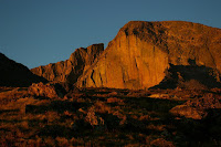
The sun was up over the horizon within a few minutes from then, and I was presented with a very large series of switchbacks leading higher up the tundra, apparently ending at the boulder field -- which I couldn't see yet. But as the sun got higher in the sky, I was treated to a spectacular orange-gold bath of light over everything, the tundra, myself, Mt. Lady Washington, Storm Peak, and the Diamond Face of Longs. I stopped and broke out the Pentax again for this. One of them (below), I think, is THE shot of the trip. Another climber asked if I'd like my picture taken, and you know.... you bet. What a memory. Even if I don't make it to the top (as I often say when I'm hiking/climbing) I get to be here. Wow. Just.... wow. No adequate words to describe it.

It was a bit hazy from forest fires out west, but you could still see Trail Tidge road and the mountains farther to the north and west. In the morning twilight I even saw a headlight on Trail Ridge -- either that or the light on one of the pieces of road construction equipment. Whatever it was, it was cool.

Daylight, the spectacular view, and the proximity of the boulder field gave me the energy to press on. I'd been struggling with oxygen since about 11,500 ft (not that the previous 2,000 feet was a piece of cake).

The boulder field has real boulders. Big ones. Not that stuff strewn around the north side of the base of Mt Lady Washington's peak. These were often the size of cars and bigger. Mike had told me it's easier to boulder hop than to try to pick your way through them, and he was right. It would've been easier without the sore knee, but the hiking pole came in handy for minimizing the impact of that.

I could hear Boulder Brook trickling underneath the boulders, but I couldn't see it through them. I had recently read that it is believed that there's about a 100' thick glacier underneath the boulderfield -- the boulders are actually helping protect it. I guess they got deposited on top of what's left of the glacier a long time ago. At one point around 1930, there was even an Inn built up here to which people rode horses, stabled them there, spent the night, and then climbed the last 1.5 to 2 miles to the top in the morning. Certainly much safer that way as you wouldn't be tired when you got to the hard part. Within a few years a 2' crack developed in one of the walls, and they tore the whole thing down. It is now believed that that was caused by glacial movement.

There's also a cool story about a little girl's ghost up around the trough area, riding a tricycle -- the daughter of the Boulderfield Inn Keeper.

There are 9 campsites at the boulder field. It's tempting to reserve one, but you have to way ahead of time, and if the weather's bad the day you planned on going, that's it (unless you are crazy and reserved it all week or something). The boulder field is inhospitible. It's a field of big huge rocks at just under 13,000 feet, for Pete's sake. There are two latrines that you have to climb stairs to get to since they weren't about to dig down in the rock.... they built a big huge bucket and put a latrine on top, about 8-10 feet above the boulders. They have some system there to keep the sewage from getting in to boulder brook. It would be interesting to know how that works, but it appears to be powered by solar panels.

There's also no roof to these things. A man can stand an pee, and he'd be visible from the shoulders up to anyone on the boulder field. Smile and wave, I guess. But people who will hike here, much less camp here, aren't the squeamish type. Hats off to the Mennonite woman.

The sites themselves are areas cleared of boulders .... sort of... there are 4' walls of boulders built in semicircles around each site, which have mainly flat bottoms upon which one can pitch a tent. When you first reach the boulder field, you can't see these sites. They blend right in. Only the tops of the tallest tents poke above the rock walls, and not many are that tall.

I stopped and used one of the latrines (phew!!!! I think the contrast with the fresh 13,000 foot air made them smell all the worse!), and pressed on to where the boulders began to climb to the keyhole where I promised myself a rest, some breakfast, and a look at the knee.

Thursday, August 30, 2007

Monday Morning, Rise and Shine

Monday, Aug 20

We brought oatmeal and dried apples, and this was the first morning we had it. We fired up my alcohol stove and I cooked up the oatmeal while Mark made coffee in his camp percolator over the fire.

There's something I forgot about camping out here. If you're not really here to camp-camp, if your camping really has more to do with saving money and being right out there in it the minute you get up so you can rush out and start seeing things -- cooking.... not so much. It's not the cooking that's the problem, it's the cleanup. There are strict regulations (and for good reason) in RMNP about food waste. There's pretty much no washing dishes at the campsite unless you carry the water there, wash, then carry the water to the grey-water sink in the bathrooms and dispose of it. Combine that with the challenges of bathing with a washcloth in cold water in front of a sink, and it's going to take you a while to get out there and start seeing the morning sights - especially if you plan on hiking, and especially if you plan on hiking up high. And you want good light for pictures. Almost every afternoon you can expect clouds to roll in at the very least, and a shower or thunderstorm to threaten you.

Better to bring granola bars and protien bars for breakfast. Coffee or tea for something hot. Its easy enough to clean up a coffee pot. Then go get cleaned up and get out there.

Mark had brought pastrami and wheat bread, which we'd had for lunch and dinner on Saturday ... and for lunch again on Sunday. It was good, and a good thing to do. Fast fixing, fast eating, fast cleanup. We're not really out here to eat. We're eating to be out here.

The oatmeal was good though, and we got out about.... oh... 9:00, 9:30-ish, and headed for the popular lake area... Bear Lake, Dream Lake, Nymph Lake, Hiyaha ... Mills Lake. I'd been to Mills Lake, so I decided we'd start at Bear and work our way up to Hiyaha.

We took some photos of Bear Lake, us in front of it, and we took other peoples pictures for them as is customary. As we left Bear Lake, Mark mentioned some rubbing on the inside of his army boots. He had the two pair of socks on and all. I suggested he put some moleskin over it, but he said he'd tough it out to Nymph Lake. It's not that far, not much more than half a mile. Nymph Lake has a lot of water lillies on it... it's lush and pretty. We left there for Dream Lake, which was crowded, and then headed for Hiyaha.

The views of Hallets and Longs Peaks were ever changing, and the higher up we got the farther up Glacier Gorge we could see. It was a beautiful afternoon with blue skies and very few fair weather clouds. I think a front had come through the night before or early that morning. There would be no showers and thunderstorms today. Each lake seemed closer to Hallets.

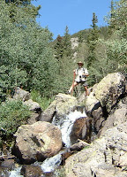
On the way up, we ran across a waterfall. It was a small one, about 12 feet, and I walked right up to it. Once there I could see a path up the waterfall by climbing some medium-sized boulders. So I climbed up the waterfall on the right-hand side. When I got to the top, Mark went to snap a picture, and I tottered a bit as I straddled two rocks. I caught my balance and a cheer went up from a few people who had gathered at the stream's edge below. Geez, I didn't realize I had an audience.

At one point, Mark stopped, saying he had to quit. Blisters had developed on his heel. We were about a half mile from Hiyaha. He said he'd head back down to Dream Lake and wait for me there. It wouldn't be long. I headed on up to Hiyaha.

On the way I met a couple coming back, and the man told me that when you get there, the trail just ends in a bunch of boulders and you wonder where the lake is. About 5 minutes later, the story matched up with one Mahtaj had told me about it a few years ago. I had forgotten. She took the Bear Lake bus up there in the rain, and she was the only one leaving down the trail from the bus. Everyone thought she was nuts. Anyway, when she made it up to Hiyaha, she saw the same boulders and climbed over them. She made her way around the lake, but the whole thing was surrounded by these same boulders. They were huge and slippery and she couldn't find the trailhead for about 40 minutes. It was cold, too.

I got there, and I could see what she meant, only it was a much nicer day for me.

I got some trail mix out and ate it, and talked with a few people. There was a pretty lady sitting on a boulder by the lake eating a sandwich, hair blowing in the wind. An older couple came up and we exchanged playing photographer down by the lake. And there was this great windswept pine tree I'd love to shoot some morning when fewer people are there so I can get the angle I want... but I'll put what I got here in this post anyway.

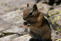
I headed back down to Dream Lake where I found Mark entertaining a chipmunk that a couple of ladies about 30 yards away had been feeding. He was used to being fed. You're not supposed to feed them. It's actually illegal. He was very fat, and came right up and sat on Mark's leg, begging. As we sat and chatted and enjoyed the view, I reached in my bag for my camera. In the process, I spilled some of my trail mix. The ziplock was open, and it came out of my bag and about a cup of it spilled out onto the rock, and into nooks and crannies that made it difficult to clean up. The chipmunk was on it in a flash, grabbing a peanut or a cashew as I scrambled to pick it up. I was just eating it right off the rock as I picked it up, as fast as I could. Hey, it's a clean mountain rock, right?

Seemingly out of nowhere, another, bigger, fatter chipmunk with fuller cheeks chased ours off. This one really didn't need to be eating any of this. Well, he didn't get much. Then he left and the other came back. I was just about finished cleaning it up.

Well, yeah, we did get a picture. I mean. Come on. I really wasn't feeding it on purpose. And I wasn't about to try to take it away from him. About that point he'd change from soft, cute little cuddly thing to fang-baring, clawing Defender Of The Food.

We packed up and hiked back down to Bear Lake and then the parking lot. From there we drove to the Longs Peak ranger station to make sure I could find the trailhead in the dark and to double-check the forecast. Tuesday still looked best. That meant... tonight. The ranger did note that a woman had been rescued there that morning after falling 200 feet from the false keyhole (off route). She had spent the night up there with some broken bones. The we drove into Estes Park and tooled in to town. Mark wanted to see the Stanley Hotel, where "The Shining" was filmed (he likes those horror movies) and stopped for a Mark photo op in front of it. Then we went looking for boots for Mark that wouldn't blister his heels. There are no department stores in Estes Park, but the information center people gave us a lead on a couple of shoe stores. Mark found a decent pair of hiking high-top sneakers built for hiking for about $30. Perfect.

Went to the grocery store, bought a couple of 6 packs, and went to the grubsteak for Elkburgers and beer. They apparently have some work exchange program with Russia and the Ukraine, as that's where all the waitresses seemed to be from. There must be some deal with the whole town of Estes Park, as we found them everywhere. They were young and pretty and had endearing accents.

Started a little fire, roasted some marshmallows. Got the instruments out for a bit and played quietly by the fire.

Set my alarm for 1:00 am. Went to bed. At first, I got extremely chilled for some reason. It was a little cooler tonight, but I think it was my body adjusting from the warmth of the fire to suddenly sliding into a cold sleeping bag. I mean, I was shaking. Hard. I put my fleece jacket on and got back in. That seemed to do the trick after about 5 minutes.

And fortunately, I again slept like a rock.

Wednesday, August 29, 2007

Two Brothers and On to the Park

Sunday, Aug 19
Unlike the night before, I slept like a rock. And unlike the night before, Mark did not. I brought along my little tiny Zen Nano MP3 player which has a "sleep therapy" track, and as such tracks go, this one is a winner. Plus I was pretty tired from a bad night's sleep, a long drive, and a full stomach. We had bought some beer in Idaho Springs and I had one before I went to bed which pretty much sealed the deal. I bought some local Colorado beer (90 shilling ale), and Mark had bought this Mississippi Mud stuff -- which was pretty good.

So I was looking for two things: coffee and a Two Brothers Deli breakfast wrap. If I'm ever in Idaho Springs in the morning, I like going to the Two Brothers Deli and getting a wrap. In the search for a graphic for this post I just found out that they have another location in Georgetown -- so we could've gone there. But the Idaho Springs location still has the same lady from 5 years ago, and from 25 years ago for all I know. Sweet and new potatoes, scrambled eggs, and a couple of cheeses wrapped in a flour tortilla with optional salsa and then lightly pressed toasted. It must be had to be appreciated. Good stuff! Then off down I-70 East just a mile or so to the US 6 exit, which leads right to C119.

After several miles, a pleasant surprise when we popped over a hill was a kind of a sun dog coming down from a cloud with a spectacular mountain backdrop. We had to stop the car. It's stuff like this that I live for out in the mountains. The unexpected spectacular sight. It was a great photo opportunity, but fleeting. As it faded, we hopped back in the car and wound our way farther north.

The coffee shop in Idaho Springs wasn't open yet. We got some coffee at Two Brothers, but were looking for a really good cup of Joe for the morning. And 119 goes through one of my favorite mountain towns (even though this would only be my second time through) -- Nederland (like "Netherland" with a "d").

It's kind of a hippie mountain town. I once read it described I think on the Hiking in Colorado site as the place where all the old Boulderites moved when the millionaires drove the housing prices up too far and drove them out.

There was a coffee shop there in a railroad car ("Happy Trails"), complete with an array of neo-hippies, cyclists, motorcyclists, and motorists like us, and the coffee was excellent. Put it in our cups and drove off into the morning light.

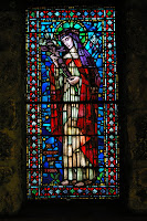
Another planned stop, which I'd been to twice before was St. Malo's Catholic Church and Retreat Center in Allenspark, at the foot of Mount Meeker (just under 14,000 feet and neighbor to Longs Peak). This is literally on the edge of Rocky Mountain National Park. You can't see Longs from here because Meeker's nearby mass blocks it from view. I knew Mark would love it... and of course, so would I. It's a very small church built of stone back in 1935. Its an interesting story involving a meteor. The setting is certainly inspirational. The morning light and blue sky was perfect for photography, and this time we went in to see the simple but beautiful inside, including a nice stained glass piece of St. Catherine.

We got to Rocky Mountain National Park about 10:30 am, hoping to scout the campsite loop for desirable camp sites and then come back and reserve whatever we found for some combination of 6 nights. The ranger there, however, said he couldn't do that there, that all reservations had to be done through the 800 number or website. We could find a site for that night (no same-day reservations) but we'd need to call the 800 number for the rest.

The 800 number was less than helpful. The lady there said there was no site available for all those nights and seemed not to get the fact that we'd move around if we had to. She gave us a choice of two rather undesirable sites. I thought I'd go book tonight's site at the gate and then see what sites near there were available via the 800 number, taking my chances again.

When I got to the campsite ranger station, there was a new guy there, Steve Miller, who was much more helpful. He not only got us a good site for the first 5 nights, but he got us another not so good but nearby one for the last night for an easy move. Only problem was, Mark wanted to pay his half with credit card and I had cash. Steve thought that would be fine, but then had trouble with the computer system. Eventually I just paid cash as a line developed behind us and a grumpy supervisor came out to see what was the matter.

We went and set up camp in D158, and then early afternoon wandered down to Moraine Park Valley and sauntered along the Big Thompson River bank, where several people were fly fishing. We saw a family of humans and a family of ducks. My duck pictures all turned out blurry since it was getting cloudy and I was using the honkin' telephoto extended all the way out. But rain was coming down the canyon and we started heading back to the car. We reached it just in time, but not before I accidentally yanked the bite valve off of my hydration pack and it spilled all over my pants. That looked real interesting to passers by, I'm sure. But I had extra pants in the car and just changed right there.

We then headed to the Beaver Meadows visitor center for a weather forecast and maybe a souvineir. I had originally planned (hoped) to wait until Thursday or Friday for my Longs Peak attempt so I'd have longer to acclimate, but the forecast definitely pointed to Tuesday for the most worry-free day. Thursday and Friday looked like "normal" summer days at that time with a 20% chance of afternoon storms. Tuesday, a post-frontal day, looked clear. I pretty much made up my mind right there. They had a pewter replica of the USGS marker from the top of Longs Peak... but I told myself I could only buy it if I succeeded in reaching the peak.

After that we went out to find a sight to see. I opted for the Lawn Lake alluvial fan. It turned out to be a great choice. I didn't remember a waterfall being there -- I think I was there in a pretty bad drought year and I think I would've remembered a sight like this. We climbed up on the boulders and had plenty of company just enjoying the sight and sound in the lengthening sunlight.

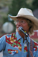
At this point, I thought maybe this would be a good night to go catch Brad Fitch, otherwise known as Cowboy Brad (Dot Com!!!) who I was introduced to over the net by college friend Sarah. Sarah and her family have come out here often and have seen him a lot. I think they even hired him for an event (anyone here order up a cowboy?) Brad does a lot of his own material, a lot of sing-along material, and a lot of John Denver. He even looks a bit like the late singer/songwriter. He and his wife Kathy seem to be involved with the Estes Park YMCA and other Estes Park endeavors. Sarah had sent him a song I wrote a couple of years ago that he may have been mildly interested in (he went a different direction with the album and didn't use it. No biggie. It wasn't that good a song anyway.) The night before they had given a John Denver Tribute concert to benefit RMNP, I believe, or some associated cause. We missed that (but 2,000 other people didn't! Good for them!), and I didn't know what other night would be good with me doing Longs on Tuesday (meaning getting up at 1:00am Monday "night") and other plans for the week. Tonight was open. We went to see one of his singalongs so I could meet him in person.


It was a very family oriented show, and of course he is more talented than I'll ever be. I'll bet the Denver Tribute concert was great. The singalong was an enjoyable show, and the kids loved it. The man is obviously a genuinely caring good person. It was a pleasure to shake his hand and get a shot with him to prove to Sarah I'd been there.

After the show, I bought his latest CD from him. We went back to camp and had either the last of the pastrami & some trail mix, or some grilled salami. And by that time it was almost time to hit the sack. Which we did fairly shortly.

The Agenda

Those who know me know that I'm typically not agenda-driven -- at least not in any strict, tight sense of the word.

Here was the agenda for the week:
  • Go to Rocky Mountain National Park, probably via the C86/C119/C72/C7 scenic route.
  • Hike.
  • Climb Longs Peak, weather permitting (the major goal)
  • Drive up Trail Ridge Road.
  • Camp.
  • See Brad Fitch, schedule permitting.
None of that in any particular order, other than getting to the Park would obviously have to come first.

I hadn't reserved a camp site. Last time, in early to mid June 2005, I had no problems staying in Moraine Park just re-reserving my camp site every night. This time I knew it might be more crowded, but I didn't want to reserve a camp site I hadn't seen. I'd stayed in 101 and 102 last time on loop A. They were a couple of walk-in sites that were up a hill with a rocky knob hiding the RV's and other non-walk-in sites. They had a nice view of Longs Peak over the trees. But they were under renovation this time. Another thing on the agenda was to check out camp sites for future reference.

The Trip Out

Friday, Aug 17 and Saturday, Aug 18

Friday afternoon I began packing the car from the spare bedroom where I had staged all my camping/hiking gear and supplies for the previous several days. For food I had a bunch of oatmeal, dried apples, dried cranberries, and my own trail mix -- peanuts, cashews, banana chips, and m&m's. Not excactly "GORP", but I like it. I'm not a fan of rasins in things. For dinners, the instant rice meals with dried texturized soy protien (tastes like chicken! -- actually, it tastes like whatever you cook it with. But it's protien.) Enough of everything for the whole week for both of us if we needed it.

I have a Ford Escort, which we were taking for a couple of reasons... one being gas mileage and the other being that slight dynamic shift that happens when you take someone else's car on your vacation. It shifts from someone coming with you on vacation your vacation to you going with someone else on their vacation. I was only too happy to have Mark along, and he was happy to be along -- I just wanted to keep it that way.

I don't know how much you know about Ford Escorts, but one thing is they're not very big. I packed two 36" military duffels with clothes and a tent, sleeping bags, air matress, and... since we were parking and camping -- sheets and a pillow. Then my food and backpacking gear -- both my new big Klamath backpack and two daypacks -- one for me, one for Mark. Hiking poles. And my 10 lbs of various camera gear. I packed my small packable tripod as well as the big one, and after a quick unsuccessful search for my monopod, I decided to forget it. I was packing enough stuff as it was.

I left pretty much half the trunk for Mark, and half the back seat. Threw my crushable hiking hat (with the wider brim to keep the sun off my neck and face) in the back window, and headed for Olathe.

This trip I didn't feel quite the separation anxiety from Vicki I normally do -- probably because she was going to Fort Wayne for the week to be with her mom while she went through some orthroscopic heart surgery to stop the flutter. I guess for some reason home's not quite home without her there, so there was no home to miss, really, and she would be with Mom.

We sat out on Mark & Cami's new deck that Mark built a few weeks ago. It's very nice. About the size of ours only without all the plants out on it. They also have a bigger table. Had a few beers and talked until around 11:00 or so and hit the sack. I only brought in from the car a clean shirt (and of course requisite clean underwear - duh!) and my dop kit.

Cami showed me what button to push on the coffee maker to have it do its thing in the morning before we went to bed. I slept pretty well for several hours, but woke up about 4:30 and couldn't go back to sleep. Probably due to anticipation of the trip. I gave up trying to sleep about 5:30 and got up and went upstairs and pressed the button on the coffee maker.

It just beeped at me.

I tried everything. There has got to be a way to get it to at least stop beeping. But unplugging for 5 minutes seemed to be the only way.

So I went and took a shower and shaved and came back down to try again. Beep-beep-beep.

Sigh.

I went out and did some re-packing in the car.

Came back in. Tried one more time. Only beeping.

So I went downstairs and took down the bed and folded the futon back up. By this time Mark and Cami were up. And, as it turned out, there was a piece missing from the coffee maker which they restored to its rightful place, and all was well with the coffee.

Had breakfast and hit the road about 7:30, with the GPS on the dash recording our progress and the MP3 player blasting out tunes from various groups we chose along the way.

The trip was fairly uneventful, other than a little rain and a few huge chunks of tire from a blown truck tire we had to deftly maneuver around at highway speed. We did see a big pickup hauling an SUV on a trailer coming in the other lane go off the road. At first I thought they were just pulling off on the shoulder, but when they actually went into the median and the truck and SUV and other stuff they were hauling were bouncing all over the place it was clear that they were going way too fast to just be pulling off to the side. If they kept coming across they'd be out of control and in our lane in oncoming traffic. I started looking for escape routes and was just about to floor it (yeah, in an escort loaded down with 500 lbs of stuff its' not used to carrying with the air conditioning running full blast) when the driver seemed to miraculously get it under control and get back on the highway in his own lane.

Whew!

We made good time. Stopped and ate a picnic lunch in McKeeny, KS in a park. It was windy and the air was drier. We even stopped by a bad antique/junk shop for a bit before travelling on. Mostly junk and the stuff that wasn't was even more expensive.

As is customary, I got off of I-70 a few miles north of Limon on 86 and headed for Castle Rock. It's a pretty drive and gets you to the mountains faster than going through Denver. Plus you don't have to see Denver. I didn't come out here to see Denver.

Well it does turn out going this way you do see a bit of the south and west side of Denver. You come up 25 to 470 and hit 70 on the west side and head up into the mountains. I figured it would be hard to get a camp site on a Summer Saturday evening in RMNP, so there was no point in heading there unless I wanted to see Brad Fitch's John Denver Tribute concert -- which I kind of wanted to see but.... it was getting late and we would miss the planned drive up C119 and C7 to Estes Park. So we looked around Idaho Springs for a room. Except for a couple of real dives for about $30 a night, they were full or too expensive, so we headed up to Georgetown (another 10 miles up the road but 1000 feet higher -- good for acclimating) and got a room at the Super 8 there for a reasonable price. The receptionist was a farily colorful guy from Bulgaria, I remember.

Went back to Idaho Springs and went to the Tommyknocker brewery (after calling Vicki and Cami to let them know where we were and we were ok and all) and had beer and appitizers while we watched the locals cheer for the Broncos on the bar televisions. Back to Georgetown and went to bed.

zzzzzzzzzzz....


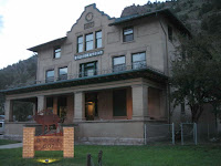
Oh, and I did snap this shot of the Idaho Springs Elks Lodge on our way back.... Vicki and I will have to hit it when we go back sometime!